You are here: Home > Network List > TA - USArray Transportable Network (new EarthScope stations) Stations List
> Station X16A Lo Mia Camp, Pine, AZ, USA > Earthquake Result Viewer
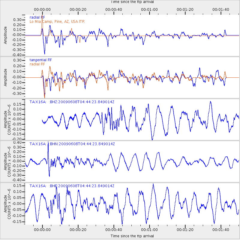
X16A Lo Mia Camp, Pine, AZ, USA - Earthquake Result Viewer
*The percent match for this event was below the threshold and hence no stack was calculated.
| Earthquake location: |
South Of Fiji Islands |
| Earthquake latitude/longitude: |
-22.2/-179.6 |
| Earthquake time(UTC): |
2009/06/08 (159) 04:33:19 GMT |
| Earthquake Depth: |
612 km |
| Earthquake Magnitude: |
5.5 MW, 5.2 MB |
| Earthquake Catalog/Contributor: |
WHDF/NEIC |
|
| Network: |
TA USArray Transportable Network (new EarthScope stations) |
| Station: |
X16A Lo Mia Camp, Pine, AZ, USA |
| Lat/Lon: |
34.42 N/111.44 W |
| Elevation: |
1759 m |
|
| Distance: |
85.8 deg |
| Az: |
50.308 deg |
| Baz: |
239.588 deg |
| Ray Param: |
$rayparam |
*The percent match for this event was below the threshold and hence was not used in the summary stack. |
|
| Radial Match: |
43.942577 % |
| Radial Bump: |
381 |
| Transverse Match: |
43.892494 % |
| Transverse Bump: |
400 |
| SOD ConfigId: |
2648 |
| Insert Time: |
2010-03-06 02:17:46.409 +0000 |
| GWidth: |
2.5 |
| Max Bumps: |
400 |
| Tol: |
0.001 |
|
Signal To Noise
| Channel | StoN | STA | LTA |
| TA:X16A: :BHN:20090608T04:44:23.849014Z | 2.4581938 | 1.3899042E-7 | 5.6541683E-8 |
| TA:X16A: :BHE:20090608T04:44:23.849014Z | 0.7835675 | 6.120357E-8 | 7.810887E-8 |
| TA:X16A: :BHZ:20090608T04:44:23.849014Z | 1.5590736 | 6.326309E-8 | 4.0577355E-8 |
| Arrivals |
| Ps | |
| PpPs | |
| PsPs/PpSs | |


