You are here: Home > Network List > TA - USArray Transportable Network (new EarthScope stations) Stations List
> Station MDND Maddock, ND, USA > Earthquake Result Viewer
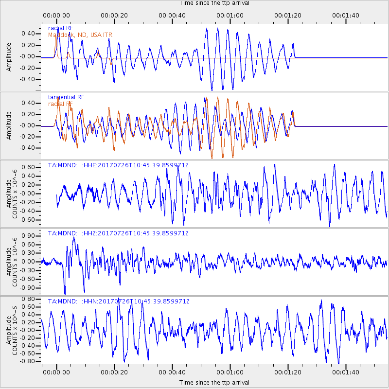
MDND Maddock, ND, USA - Earthquake Result Viewer
*The percent match for this event was below the threshold and hence no stack was calculated.
| Earthquake location: |
Southeast Of Ryukyu Islands |
| Earthquake latitude/longitude: |
26.9/130.2 |
| Earthquake time(UTC): |
2017/07/26 (207) 10:32:57 GMT |
| Earthquake Depth: |
10 km |
| Earthquake Magnitude: |
5.9 Mww |
| Earthquake Catalog/Contributor: |
NEIC PDE/us |
|
| Network: |
TA USArray Transportable Network (new EarthScope stations) |
| Station: |
MDND Maddock, ND, USA |
| Lat/Lon: |
47.85 N/99.60 W |
| Elevation: |
479 m |
|
| Distance: |
93.2 deg |
| Az: |
31.011 deg |
| Baz: |
316.927 deg |
| Ray Param: |
$rayparam |
*The percent match for this event was below the threshold and hence was not used in the summary stack. |
|
| Radial Match: |
55.65562 % |
| Radial Bump: |
353 |
| Transverse Match: |
53.799084 % |
| Transverse Bump: |
400 |
| SOD ConfigId: |
13570011 |
| Insert Time: |
2019-04-28 11:28:20.292 +0000 |
| GWidth: |
2.5 |
| Max Bumps: |
400 |
| Tol: |
0.001 |
|
Signal To Noise
| Channel | StoN | STA | LTA |
| TA:MDND: :HHZ:20170726T10:45:39.859971Z | 4.5362854 | 3.9746354E-7 | 8.7618716E-8 |
| TA:MDND: :HHN:20170726T10:45:39.859971Z | 1.6862872 | 3.477528E-7 | 2.0622396E-7 |
| TA:MDND: :HHE:20170726T10:45:39.859971Z | 1.5510756 | 2.3617936E-7 | 1.5226811E-7 |
| Arrivals |
| Ps | |
| PpPs | |
| PsPs/PpSs | |


