You are here: Home > Network List > TA - USArray Transportable Network (new EarthScope stations) Stations List
> Station TPFO Pinon Flats, CA, USA > Earthquake Result Viewer
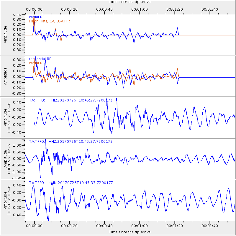
TPFO Pinon Flats, CA, USA - Earthquake Result Viewer
*The percent match for this event was below the threshold and hence no stack was calculated.
| Earthquake location: |
Southeast Of Ryukyu Islands |
| Earthquake latitude/longitude: |
26.9/130.2 |
| Earthquake time(UTC): |
2017/07/26 (207) 10:32:57 GMT |
| Earthquake Depth: |
10 km |
| Earthquake Magnitude: |
5.9 Mww |
| Earthquake Catalog/Contributor: |
NEIC PDE/us |
|
| Network: |
TA USArray Transportable Network (new EarthScope stations) |
| Station: |
TPFO Pinon Flats, CA, USA |
| Lat/Lon: |
33.61 N/116.45 W |
| Elevation: |
1275 m |
|
| Distance: |
92.7 deg |
| Az: |
50.089 deg |
| Baz: |
304.853 deg |
| Ray Param: |
$rayparam |
*The percent match for this event was below the threshold and hence was not used in the summary stack. |
|
| Radial Match: |
45.172363 % |
| Radial Bump: |
400 |
| Transverse Match: |
76.919975 % |
| Transverse Bump: |
392 |
| SOD ConfigId: |
13570011 |
| Insert Time: |
2019-04-28 11:29:06.635 +0000 |
| GWidth: |
2.5 |
| Max Bumps: |
400 |
| Tol: |
0.001 |
|
Signal To Noise
| Channel | StoN | STA | LTA |
| TA:TPFO: :HHZ:20170726T10:45:37.720017Z | 2.745212 | 4.936021E-7 | 1.7980473E-7 |
| TA:TPFO: :HHN:20170726T10:45:37.720017Z | 1.8788774 | 2.9382002E-7 | 1.5638062E-7 |
| TA:TPFO: :HHE:20170726T10:45:37.720017Z | 1.3974463 | 1.661503E-7 | 1.18895656E-7 |
| Arrivals |
| Ps | |
| PpPs | |
| PsPs/PpSs | |


