You are here: Home > Network List > AV - Alaska Volcano Observatory Stations List
> Station MAPS Pakushin Southeast, Makushin Volcano, Alaska > Earthquake Result Viewer
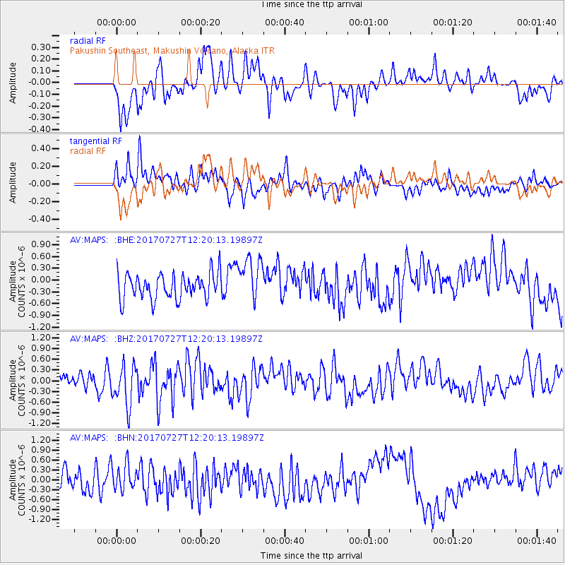
MAPS Pakushin Southeast, Makushin Volcano, Alaska - Earthquake Result Viewer
*The percent match for this event was below the threshold and hence no stack was calculated.
| Earthquake location: |
Buru, Indonesia |
| Earthquake latitude/longitude: |
-3.5/126.1 |
| Earthquake time(UTC): |
2017/07/27 (208) 12:08:38 GMT |
| Earthquake Depth: |
15 km |
| Earthquake Magnitude: |
5.8 Mww |
| Earthquake Catalog/Contributor: |
NEIC PDE/us |
|
| Network: |
AV Alaska Volcano Observatory |
| Station: |
MAPS Pakushin Southeast, Makushin Volcano, Alaska |
| Lat/Lon: |
53.81 N/166.94 W |
| Elevation: |
333 m |
|
| Distance: |
79.5 deg |
| Az: |
33.722 deg |
| Baz: |
249.116 deg |
| Ray Param: |
$rayparam |
*The percent match for this event was below the threshold and hence was not used in the summary stack. |
|
| Radial Match: |
69.97674 % |
| Radial Bump: |
400 |
| Transverse Match: |
59.377785 % |
| Transverse Bump: |
400 |
| SOD ConfigId: |
13570011 |
| Insert Time: |
2019-04-28 11:31:27.313 +0000 |
| GWidth: |
2.5 |
| Max Bumps: |
400 |
| Tol: |
0.001 |
|
Signal To Noise
| Channel | StoN | STA | LTA |
| AV:MAPS: :BHZ:20170727T12:20:13.19897Z | 2.9893837 | 5.9056316E-7 | 1.9755349E-7 |
| AV:MAPS: :BHN:20170727T12:20:13.19897Z | 1.6042873 | 4.038102E-7 | 2.517069E-7 |
| AV:MAPS: :BHE:20170727T12:20:13.19897Z | 1.7369432 | 5.6467644E-7 | 3.250978E-7 |
| Arrivals |
| Ps | |
| PpPs | |
| PsPs/PpSs | |


