You are here: Home > Network List > CN - Canadian National Seismograph Network Stations List
> Station INK INUVIK, NT > Earthquake Result Viewer
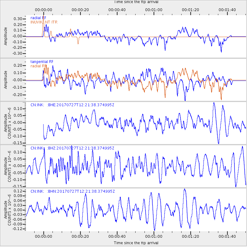
INK INUVIK, NT - Earthquake Result Viewer
*The percent match for this event was below the threshold and hence no stack was calculated.
| Earthquake location: |
Buru, Indonesia |
| Earthquake latitude/longitude: |
-3.5/126.1 |
| Earthquake time(UTC): |
2017/07/27 (208) 12:08:38 GMT |
| Earthquake Depth: |
15 km |
| Earthquake Magnitude: |
5.8 Mww |
| Earthquake Catalog/Contributor: |
NEIC PDE/us |
|
| Network: |
CN Canadian National Seismograph Network |
| Station: |
INK INUVIK, NT |
| Lat/Lon: |
68.31 N/133.53 W |
| Elevation: |
44 m |
|
| Distance: |
97.1 deg |
| Az: |
21.624 deg |
| Baz: |
278.376 deg |
| Ray Param: |
$rayparam |
*The percent match for this event was below the threshold and hence was not used in the summary stack. |
|
| Radial Match: |
41.064934 % |
| Radial Bump: |
400 |
| Transverse Match: |
51.600716 % |
| Transverse Bump: |
400 |
| SOD ConfigId: |
13570011 |
| Insert Time: |
2019-04-28 11:31:37.369 +0000 |
| GWidth: |
2.5 |
| Max Bumps: |
400 |
| Tol: |
0.001 |
|
Signal To Noise
| Channel | StoN | STA | LTA |
| CN:INK: :BHZ:20170727T12:21:38.374995Z | 1.4668442 | 6.9900466E-8 | 4.7653636E-8 |
| CN:INK: :BHN:20170727T12:21:38.374995Z | 0.99757946 | 4.010828E-8 | 4.02056E-8 |
| CN:INK: :BHE:20170727T12:21:38.374995Z | 0.72662574 | 3.3812736E-8 | 4.6533906E-8 |
| Arrivals |
| Ps | |
| PpPs | |
| PsPs/PpSs | |


