You are here: Home > Network List > TA - USArray Transportable Network (new EarthScope stations) Stations List
> Station E25A Miller Ranch, Amidon, ND, USA > Earthquake Result Viewer
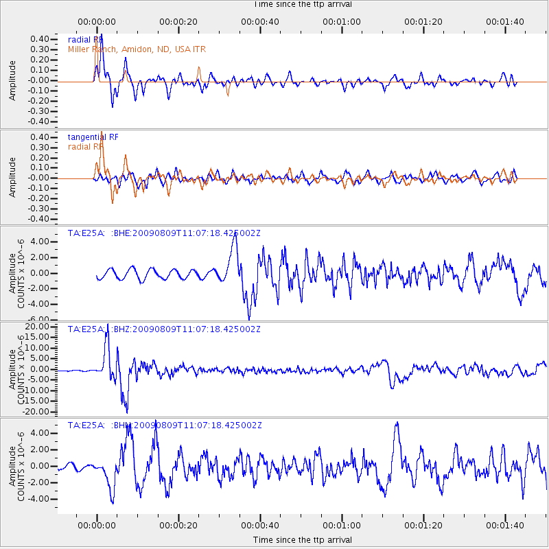
E25A Miller Ranch, Amidon, ND, USA - Earthquake Result Viewer
*The percent match for this event was below the threshold and hence no stack was calculated.
| Earthquake location: |
Near S. Coast Of Honshu, Japan |
| Earthquake latitude/longitude: |
33.2/137.9 |
| Earthquake time(UTC): |
2009/08/09 (221) 10:55:55 GMT |
| Earthquake Depth: |
297 km |
| Earthquake Magnitude: |
6.5 MB, 7.1 MW, 7.1 MW |
| Earthquake Catalog/Contributor: |
WHDF/NEIC |
|
| Network: |
TA USArray Transportable Network (new EarthScope stations) |
| Station: |
E25A Miller Ranch, Amidon, ND, USA |
| Lat/Lon: |
46.50 N/103.40 W |
| Elevation: |
885 m |
|
| Distance: |
83.3 deg |
| Az: |
37.609 deg |
| Baz: |
312.183 deg |
| Ray Param: |
$rayparam |
*The percent match for this event was below the threshold and hence was not used in the summary stack. |
|
| Radial Match: |
92.6103 % |
| Radial Bump: |
400 |
| Transverse Match: |
76.82331 % |
| Transverse Bump: |
400 |
| SOD ConfigId: |
2622 |
| Insert Time: |
2010-03-06 02:20:04.747 +0000 |
| GWidth: |
2.5 |
| Max Bumps: |
400 |
| Tol: |
0.001 |
|
Signal To Noise
| Channel | StoN | STA | LTA |
| TA:E25A: :BHZ:20090809T11:07:18.425002Z | 59.050266 | 7.863275E-6 | 1.331624E-7 |
| TA:E25A: :BHN:20090809T11:07:18.425002Z | 5.7854295 | 1.8814409E-6 | 3.2520333E-7 |
| TA:E25A: :BHE:20090809T11:07:18.425002Z | 4.1295304 | 2.421309E-6 | 5.8634004E-7 |
| Arrivals |
| Ps | |
| PpPs | |
| PsPs/PpSs | |


