You are here: Home > Network List > TA - USArray Transportable Network (new EarthScope stations) Stations List
> Station I30M Mount Dempster, Yukon, CAN > Earthquake Result Viewer
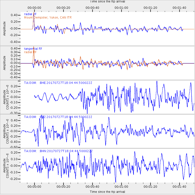
I30M Mount Dempster, Yukon, CAN - Earthquake Result Viewer
*The percent match for this event was below the threshold and hence no stack was calculated.
| Earthquake location: |
North Atlantic Ocean |
| Earthquake latitude/longitude: |
13.4/-49.4 |
| Earthquake time(UTC): |
2017/07/27 (208) 17:53:25 GMT |
| Earthquake Depth: |
10 km |
| Earthquake Magnitude: |
5.9 Mww |
| Earthquake Catalog/Contributor: |
NEIC PDE/us |
|
| Network: |
TA USArray Transportable Network (new EarthScope stations) |
| Station: |
I30M Mount Dempster, Yukon, CAN |
| Lat/Lon: |
65.22 N/136.38 W |
| Elevation: |
1399 m |
|
| Distance: |
76.7 deg |
| Az: |
334.378 deg |
| Baz: |
87.005 deg |
| Ray Param: |
$rayparam |
*The percent match for this event was below the threshold and hence was not used in the summary stack. |
|
| Radial Match: |
66.75112 % |
| Radial Bump: |
400 |
| Transverse Match: |
73.11022 % |
| Transverse Bump: |
400 |
| SOD ConfigId: |
13570011 |
| Insert Time: |
2019-04-28 11:44:25.914 +0000 |
| GWidth: |
2.5 |
| Max Bumps: |
400 |
| Tol: |
0.001 |
|
Signal To Noise
| Channel | StoN | STA | LTA |
| TA:I30M: :BHZ:20170727T18:04:44.500022Z | 6.901129 | 2.7270758E-7 | 3.9516376E-8 |
| TA:I30M: :BHN:20170727T18:04:44.500022Z | 1.793959 | 5.082262E-8 | 2.8329866E-8 |
| TA:I30M: :BHE:20170727T18:04:44.500022Z | 2.1396616 | 9.345936E-8 | 4.3679506E-8 |
| Arrivals |
| Ps | |
| PpPs | |
| PsPs/PpSs | |


