
P21A Newcastle, CO, USA - Earthquake Result Viewer
| ||||||||||||||||||
| ||||||||||||||||||
| ||||||||||||||||||
|
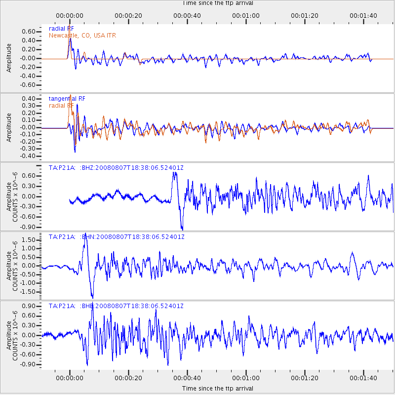
Signal To Noise
| Channel | StoN | STA | LTA |
| TA:P21A: :BHN:20080807T18:38:06.52401Z | 6.0340943 | 3.880092E-7 | 6.430281E-8 |
| TA:P21A: :BHE:20080807T18:38:06.52401Z | 2.3314402 | 1.670008E-7 | 7.162989E-8 |
| TA:P21A: :BHZ:20080807T18:38:06.52401Z | 1.3021202 | 1.1896994E-7 | 9.1366324E-8 |
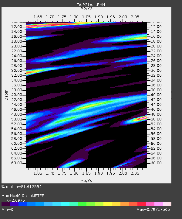
| Arrivals | |
| Ps | 9.0 SECOND |
| PpPs | 23 SECOND |
| PsPs/PpSs | 32 SECOND |

