You are here: Home > Network List > UW - Pacific Northwest Regional Seismic Network Stations List
> Station UMAT Pilot Rock, OR, USA > Earthquake Result Viewer
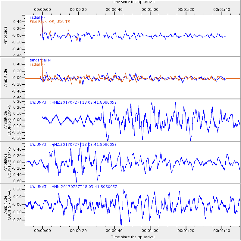
UMAT Pilot Rock, OR, USA - Earthquake Result Viewer
*The percent match for this event was below the threshold and hence no stack was calculated.
| Earthquake location: |
North Atlantic Ocean |
| Earthquake latitude/longitude: |
13.4/-49.4 |
| Earthquake time(UTC): |
2017/07/27 (208) 17:53:25 GMT |
| Earthquake Depth: |
10 km |
| Earthquake Magnitude: |
5.9 Mww |
| Earthquake Catalog/Contributor: |
NEIC PDE/us |
|
| Network: |
UW Pacific Northwest Regional Seismic Network |
| Station: |
UMAT Pilot Rock, OR, USA |
| Lat/Lon: |
45.29 N/118.96 W |
| Elevation: |
1318 m |
|
| Distance: |
66.3 deg |
| Az: |
313.723 deg |
| Baz: |
94.891 deg |
| Ray Param: |
$rayparam |
*The percent match for this event was below the threshold and hence was not used in the summary stack. |
|
| Radial Match: |
71.33155 % |
| Radial Bump: |
400 |
| Transverse Match: |
75.600006 % |
| Transverse Bump: |
400 |
| SOD ConfigId: |
13570011 |
| Insert Time: |
2019-04-28 11:46:23.991 +0000 |
| GWidth: |
2.5 |
| Max Bumps: |
400 |
| Tol: |
0.001 |
|
Signal To Noise
| Channel | StoN | STA | LTA |
| UW:UMAT: :HHZ:20170727T18:03:41.808005Z | 3.655073 | 1.6719996E-7 | 4.574463E-8 |
| UW:UMAT: :HHN:20170727T18:03:41.808005Z | 1.0522506 | 4.17117E-8 | 3.964046E-8 |
| UW:UMAT: :HHE:20170727T18:03:41.808005Z | 1.8588089 | 7.8327396E-8 | 4.2138485E-8 |
| Arrivals |
| Ps | |
| PpPs | |
| PsPs/PpSs | |


