P21A Newcastle, CO, USA - Earthquake Result Viewer
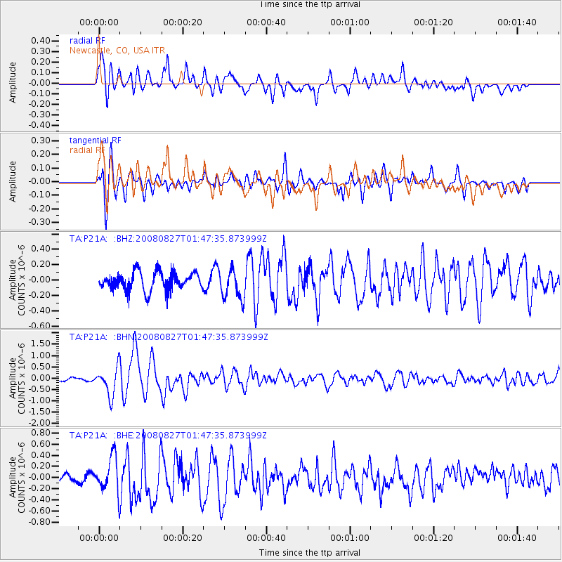
Earthquake location: Lake Baykal Region, Russia
Earthquake latitude/longitude: 51.6/104.2
Earthquake time(UTC): 2008/08/27 (240) 01:35:32 GMT
Earthquake Depth: 16 km
Earthquake Magnitude: 5.8 MB, 6.2 MS, 6.2 MW, 6.2 MW
Earthquake Catalog/Contributor: WHDF/NEIC
Network: TA USArray Transportable Network (new EarthScope stations)
Station: P21A Newcastle, CO, USA
Lat/Lon: 39.52 N/107.45 W
Elevation: 2097 m
Distance: 85.1 deg
Az: 24.005 deg
Baz: 340.852 deg
Ray Param: 0.044967946
Estimated Moho Depth: 16.0 km
Estimated Crust Vp/Vs: 2.09
Assumed Crust Vp: 6.306 km/s
Estimated Crust Vs: 3.014 km/s
Estimated Crust Poisson's Ratio: 0.35
Radial Match: 82.55582 %
Radial Bump: 400
Transverse Match: 78.11337 %
Transverse Bump: 400
SOD ConfigId: 2504
Insert Time: 2010-03-06 02:21:22.594 +0000
GWidth: 2.5
Max Bumps: 400
Tol: 0.001

Signal To Noise

ChannelStoNSTALTA
TA:P21A: :BHN:20080827T01:47:35.873999Z11.744316.3505405E-75.4073336E-8
TA:P21A: :BHE:20080827T01:47:35.873999Z3.0316163.2462583E-71.0708013E-7
TA:P21A: :BHZ:20080827T01:47:35.873999Z1.70897331.9830895E-71.1603982E-7
Arrivals
Ps2.8 SECOND
PpPs7.7 SECOND
PsPs/PpSs11 SECOND