You are here: Home > Network List > IU - Global Seismograph Network (GSN - IRIS/USGS) Stations List
> Station POHA Pohakuloa, Hawaii, USA > Earthquake Result Viewer
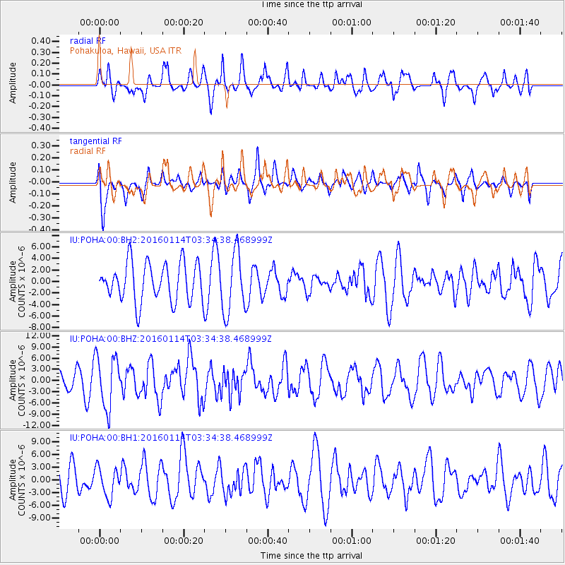
POHA Pohakuloa, Hawaii, USA - Earthquake Result Viewer
*The percent match for this event was below the threshold and hence no stack was calculated.
| Earthquake location: |
Hokkaido, Japan Region |
| Earthquake latitude/longitude: |
42.0/142.7 |
| Earthquake time(UTC): |
2016/01/14 (014) 03:25:34 GMT |
| Earthquake Depth: |
51 km |
| Earthquake Magnitude: |
6.7 MWP, 6.7 MI |
| Earthquake Catalog/Contributor: |
NEIC PDE/NEIC COMCAT |
|
| Network: |
IU Global Seismograph Network (GSN - IRIS/USGS) |
| Station: |
POHA Pohakuloa, Hawaii, USA |
| Lat/Lon: |
19.76 N/155.53 W |
| Elevation: |
1990 m |
|
| Distance: |
56.2 deg |
| Az: |
93.193 deg |
| Baz: |
307.744 deg |
| Ray Param: |
$rayparam |
*The percent match for this event was below the threshold and hence was not used in the summary stack. |
|
| Radial Match: |
62.515335 % |
| Radial Bump: |
400 |
| Transverse Match: |
61.14875 % |
| Transverse Bump: |
369 |
| SOD ConfigId: |
1399611 |
| Insert Time: |
2016-01-28 04:28:27.926 +0000 |
| GWidth: |
2.5 |
| Max Bumps: |
400 |
| Tol: |
0.001 |
|
Signal To Noise
| Channel | StoN | STA | LTA |
| IU:POHA:00:BHZ:20160114T03:34:38.468999Z | 3.3609877 | 6.934481E-6 | 2.0632272E-6 |
| IU:POHA:00:BH1:20160114T03:34:38.468999Z | 0.91388935 | 3.4645734E-6 | 3.7910206E-6 |
| IU:POHA:00:BH2:20160114T03:34:38.468999Z | 1.6241264 | 5.4110874E-6 | 3.3316908E-6 |
| Arrivals |
| Ps | |
| PpPs | |
| PsPs/PpSs | |


