You are here: Home > Network List > AK - Alaska Regional Network Stations List
> Station CUT Chulitna, AK, USA > Earthquake Result Viewer
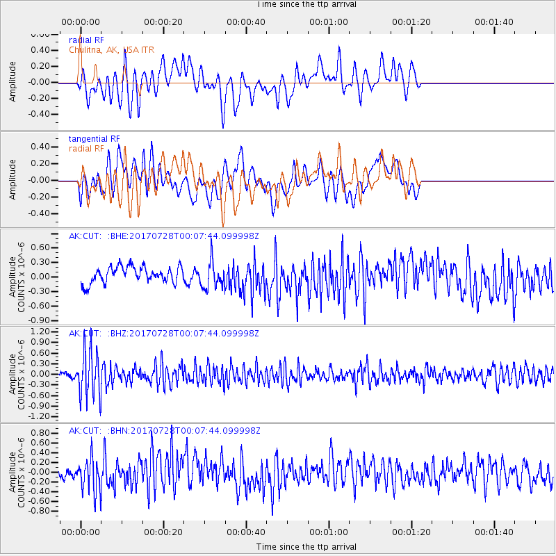
CUT Chulitna, AK, USA - Earthquake Result Viewer
*The percent match for this event was below the threshold and hence no stack was calculated.
| Earthquake location: |
Southeast Of Honshu, Japan |
| Earthquake latitude/longitude: |
29.3/143.0 |
| Earthquake time(UTC): |
2017/07/27 (208) 23:58:52 GMT |
| Earthquake Depth: |
10 km |
| Earthquake Magnitude: |
5.3 Mww |
| Earthquake Catalog/Contributor: |
NEIC PDE/us |
|
| Network: |
AK Alaska Regional Network |
| Station: |
CUT Chulitna, AK, USA |
| Lat/Lon: |
62.41 N/150.26 W |
| Elevation: |
574 m |
|
| Distance: |
53.8 deg |
| Az: |
32.038 deg |
| Baz: |
264.434 deg |
| Ray Param: |
$rayparam |
*The percent match for this event was below the threshold and hence was not used in the summary stack. |
|
| Radial Match: |
47.403088 % |
| Radial Bump: |
400 |
| Transverse Match: |
46.719177 % |
| Transverse Bump: |
400 |
| SOD ConfigId: |
13570011 |
| Insert Time: |
2019-04-28 11:48:12.698 +0000 |
| GWidth: |
2.5 |
| Max Bumps: |
400 |
| Tol: |
0.001 |
|
Signal To Noise
| Channel | StoN | STA | LTA |
| AK:CUT: :BHZ:20170728T00:07:44.099998Z | 8.51091 | 6.533186E-7 | 7.676248E-8 |
| AK:CUT: :BHN:20170728T00:07:44.099998Z | 2.1647885 | 3.4094168E-7 | 1.5749421E-7 |
| AK:CUT: :BHE:20170728T00:07:44.099998Z | 1.7755431 | 2.923248E-7 | 1.6463966E-7 |
| Arrivals |
| Ps | |
| PpPs | |
| PsPs/PpSs | |


