You are here: Home > Network List > TA - USArray Transportable Network (new EarthScope stations) Stations List
> Station P21A Newcastle, CO, USA > Earthquake Result Viewer
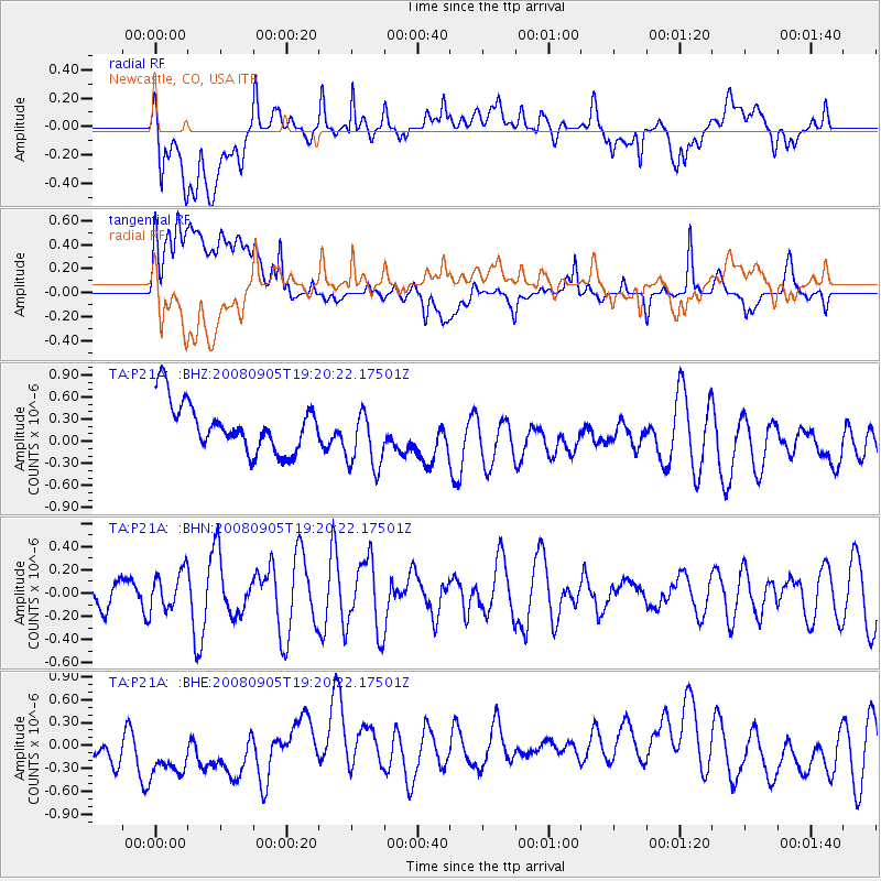
P21A Newcastle, CO, USA - Earthquake Result Viewer
*The percent match for this event was below the threshold and hence no stack was calculated.
| Earthquake location: |
North Of Ascension Island |
| Earthquake latitude/longitude: |
-1.2/-14.0 |
| Earthquake time(UTC): |
2008/09/05 (249) 19:07:38 GMT |
| Earthquake Depth: |
10 km |
| Earthquake Magnitude: |
5.5 MB, 5.5 MS, 5.8 MW, 5.8 MW |
| Earthquake Catalog/Contributor: |
WHDF/NEIC |
|
| Network: |
TA USArray Transportable Network (new EarthScope stations) |
| Station: |
P21A Newcastle, CO, USA |
| Lat/Lon: |
39.52 N/107.45 W |
| Elevation: |
2097 m |
|
| Distance: |
93.4 deg |
| Az: |
309.339 deg |
| Baz: |
88.684 deg |
| Ray Param: |
$rayparam |
*The percent match for this event was below the threshold and hence was not used in the summary stack. |
|
| Radial Match: |
48.034695 % |
| Radial Bump: |
400 |
| Transverse Match: |
29.126184 % |
| Transverse Bump: |
400 |
| SOD ConfigId: |
2560 |
| Insert Time: |
2010-03-06 02:22:01.074 +0000 |
| GWidth: |
2.5 |
| Max Bumps: |
400 |
| Tol: |
0.001 |
|
Signal To Noise
| Channel | StoN | STA | LTA |
| TA:P21A: :BHN:20080905T19:20:22.17501Z | 1.37323 | 1.621165E-7 | 1.18054885E-7 |
| TA:P21A: :BHE:20080905T19:20:22.17501Z | 1.3639143 | 6.093836E-7 | 4.4679027E-7 |
| TA:P21A: :BHZ:20080905T19:20:22.17501Z | 1.2846669 | 4.2192937E-7 | 3.2843485E-7 |
| Arrivals |
| Ps | |
| PpPs | |
| PsPs/PpSs | |


