You are here: Home > Network List > AV - Alaska Volcano Observatory Stations List
> Station SPCR Ckakachatna River, Mount Spurr, Alaska > Earthquake Result Viewer
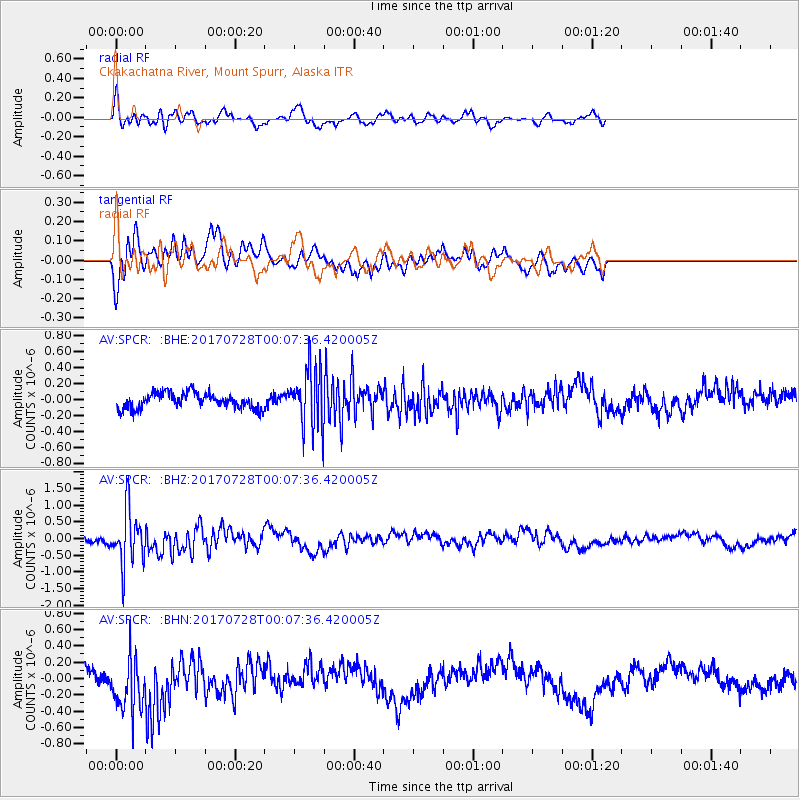
SPCR Ckakachatna River, Mount Spurr, Alaska - Earthquake Result Viewer
*The percent match for this event was below the threshold and hence no stack was calculated.
| Earthquake location: |
Southeast Of Honshu, Japan |
| Earthquake latitude/longitude: |
29.3/143.0 |
| Earthquake time(UTC): |
2017/07/27 (208) 23:58:52 GMT |
| Earthquake Depth: |
10 km |
| Earthquake Magnitude: |
5.3 Mww |
| Earthquake Catalog/Contributor: |
NEIC PDE/us |
|
| Network: |
AV Alaska Volcano Observatory |
| Station: |
SPCR Ckakachatna River, Mount Spurr, Alaska |
| Lat/Lon: |
61.20 N/152.21 W |
| Elevation: |
984 m |
|
| Distance: |
52.7 deg |
| Az: |
33.419 deg |
| Baz: |
263.547 deg |
| Ray Param: |
$rayparam |
*The percent match for this event was below the threshold and hence was not used in the summary stack. |
|
| Radial Match: |
72.73154 % |
| Radial Bump: |
400 |
| Transverse Match: |
51.308872 % |
| Transverse Bump: |
400 |
| SOD ConfigId: |
13570011 |
| Insert Time: |
2019-04-28 11:49:30.017 +0000 |
| GWidth: |
2.5 |
| Max Bumps: |
400 |
| Tol: |
0.001 |
|
Signal To Noise
| Channel | StoN | STA | LTA |
| AV:SPCR: :BHZ:20170728T00:07:36.420005Z | 3.5454047 | 8.2208174E-7 | 2.3187249E-7 |
| AV:SPCR: :BHN:20170728T00:07:36.420005Z | 2.4860735 | 3.373764E-7 | 1.3570653E-7 |
| AV:SPCR: :BHE:20170728T00:07:36.420005Z | 3.961113 | 3.830172E-7 | 9.6694336E-8 |
| Arrivals |
| Ps | |
| PpPs | |
| PsPs/PpSs | |


