You are here: Home > Network List > TA - USArray Transportable Network (new EarthScope stations) Stations List
> Station P21A Newcastle, CO, USA > Earthquake Result Viewer
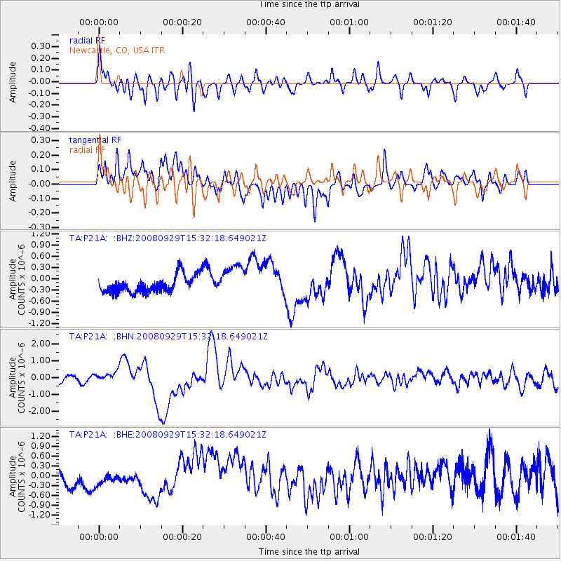
P21A Newcastle, CO, USA - Earthquake Result Viewer
*The percent match for this event was below the threshold and hence no stack was calculated.
| Earthquake location: |
Kermadec Islands, New Zealand |
| Earthquake latitude/longitude: |
-29.8/-177.7 |
| Earthquake time(UTC): |
2008/09/29 (273) 15:19:31 GMT |
| Earthquake Depth: |
36 km |
| Earthquake Magnitude: |
6.5 MB, 6.7 MS, 7.0 MW, 7.0 MW |
| Earthquake Catalog/Contributor: |
WHDF/NEIC |
|
| Network: |
TA USArray Transportable Network (new EarthScope stations) |
| Station: |
P21A Newcastle, CO, USA |
| Lat/Lon: |
39.52 N/107.45 W |
| Elevation: |
2097 m |
|
| Distance: |
94.9 deg |
| Az: |
46.933 deg |
| Baz: |
235.22 deg |
| Ray Param: |
$rayparam |
*The percent match for this event was below the threshold and hence was not used in the summary stack. |
|
| Radial Match: |
78.23744 % |
| Radial Bump: |
400 |
| Transverse Match: |
67.41489 % |
| Transverse Bump: |
400 |
| SOD ConfigId: |
2560 |
| Insert Time: |
2010-03-06 02:22:22.290 +0000 |
| GWidth: |
2.5 |
| Max Bumps: |
400 |
| Tol: |
0.001 |
|
Signal To Noise
| Channel | StoN | STA | LTA |
| TA:P21A: :BHN:20080929T15:32:18.649021Z | 1.7915556 | 2.877644E-7 | 1.6062265E-7 |
| TA:P21A: :BHE:20080929T15:32:18.649021Z | 0.7059784 | 2.192039E-7 | 3.104966E-7 |
| TA:P21A: :BHZ:20080929T15:32:18.649021Z | 1.9057767 | 4.3653213E-7 | 2.2905732E-7 |
| Arrivals |
| Ps | |
| PpPs | |
| PsPs/PpSs | |


