You are here: Home > Network List > CN - Canadian National Seismograph Network Stations List
> Station INK INUVIK, NT > Earthquake Result Viewer
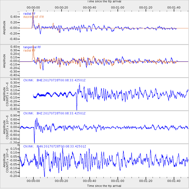
INK INUVIK, NT - Earthquake Result Viewer
*The percent match for this event was below the threshold and hence no stack was calculated.
| Earthquake location: |
Southeast Of Honshu, Japan |
| Earthquake latitude/longitude: |
29.3/143.0 |
| Earthquake time(UTC): |
2017/07/27 (208) 23:58:52 GMT |
| Earthquake Depth: |
10 km |
| Earthquake Magnitude: |
5.3 Mww |
| Earthquake Catalog/Contributor: |
NEIC PDE/us |
|
| Network: |
CN Canadian National Seismograph Network |
| Station: |
INK INUVIK, NT |
| Lat/Lon: |
68.31 N/133.53 W |
| Elevation: |
44 m |
|
| Distance: |
60.8 deg |
| Az: |
25.045 deg |
| Baz: |
275.876 deg |
| Ray Param: |
$rayparam |
*The percent match for this event was below the threshold and hence was not used in the summary stack. |
|
| Radial Match: |
67.31689 % |
| Radial Bump: |
400 |
| Transverse Match: |
65.09709 % |
| Transverse Bump: |
400 |
| SOD ConfigId: |
13570011 |
| Insert Time: |
2019-04-28 11:50:47.941 +0000 |
| GWidth: |
2.5 |
| Max Bumps: |
400 |
| Tol: |
0.001 |
|
Signal To Noise
| Channel | StoN | STA | LTA |
| CN:INK: :BHZ:20170728T00:08:33.42501Z | 8.632074 | 3.8552946E-7 | 4.4662436E-8 |
| CN:INK: :BHN:20170728T00:08:33.42501Z | 1.7084727 | 5.7411064E-8 | 3.3603737E-8 |
| CN:INK: :BHE:20170728T00:08:33.42501Z | 3.936909 | 1.4141443E-7 | 3.592017E-8 |
| Arrivals |
| Ps | |
| PpPs | |
| PsPs/PpSs | |


