You are here: Home > Network List > TA - USArray Transportable Network (new EarthScope stations) Stations List
> Station P21A Newcastle, CO, USA > Earthquake Result Viewer
P21A Newcastle, CO, USA - Earthquake Result Viewer
*The percent match for this event was below the threshold and hence no stack was calculated.
| Earthquake location: |
Tonga Islands |
| Earthquake latitude/longitude: |
-20.8/-174.3 |
| Earthquake time(UTC): |
2009/07/30 (211) 20:05:34 GMT |
| Earthquake Depth: |
10 km |
| Earthquake Magnitude: |
5.9 MB, 5.7 MS, 5.8 MW, 5.7 MW |
| Earthquake Catalog/Contributor: |
WHDF/NEIC |
|
| Network: |
TA USArray Transportable Network (new EarthScope stations) |
| Station: |
P21A Newcastle, CO, USA |
| Lat/Lon: |
39.52 N/107.45 W |
| Elevation: |
2097 m |
|
| Distance: |
86.5 deg |
| Az: |
45.417 deg |
| Baz: |
239.462 deg |
| Ray Param: |
$rayparam |
*The percent match for this event was below the threshold and hence was not used in the summary stack. |
|
| Radial Match: |
66.42635 % |
| Radial Bump: |
400 |
| Transverse Match: |
49.52106 % |
| Transverse Bump: |
400 |
| SOD ConfigId: |
2622 |
| Insert Time: |
2010-03-06 02:22:28.924 +0000 |
| GWidth: |
2.5 |
| Max Bumps: |
400 |
| Tol: |
0.001 |
|
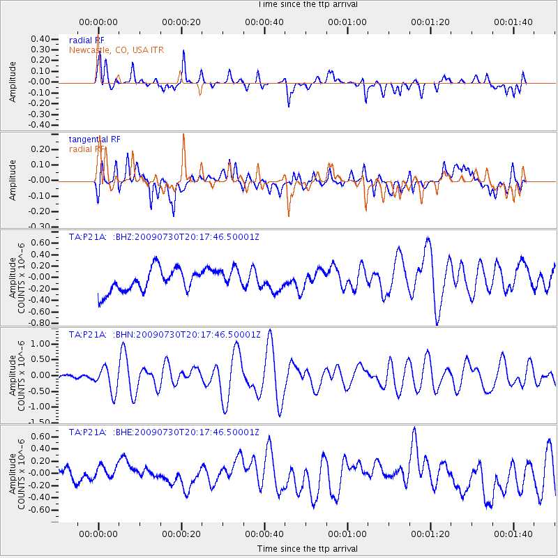
Signal To Noise
| Channel | StoN | STA | LTA |
| TA:P21A: :BHN:20090730T20:17:46.50001Z | 5.424215 | 4.0531825E-7 | 7.472386E-8 |
| TA:P21A: :BHE:20090730T20:17:46.50001Z | 1.0694264 | 1.7250822E-7 | 1.6130912E-7 |
| TA:P21A: :BHZ:20090730T20:17:46.50001Z | 0.88260216 | 1.7444671E-7 | 1.9765045E-7 |
| Arrivals |
| Ps | |
| PpPs | |
| PsPs/PpSs | |


