You are here: Home > Network List > TA - USArray Transportable Network (new EarthScope stations) Stations List
> Station P21A Newcastle, CO, USA > Earthquake Result Viewer
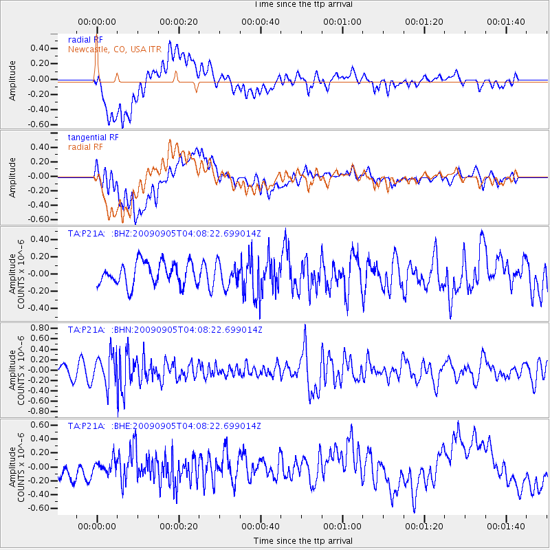
P21A Newcastle, CO, USA - Earthquake Result Viewer
*The percent match for this event was below the threshold and hence no stack was calculated.
| Earthquake location: |
Southern Peru |
| Earthquake latitude/longitude: |
-15.1/-70.2 |
| Earthquake time(UTC): |
2009/09/05 (248) 03:58:39 GMT |
| Earthquake Depth: |
210 km |
| Earthquake Magnitude: |
5.8 MW, 5.2 MB, 5.8 MW |
| Earthquake Catalog/Contributor: |
WHDF/NEIC |
|
| Network: |
TA USArray Transportable Network (new EarthScope stations) |
| Station: |
P21A Newcastle, CO, USA |
| Lat/Lon: |
39.52 N/107.45 W |
| Elevation: |
2097 m |
|
| Distance: |
64.5 deg |
| Az: |
328.791 deg |
| Baz: |
139.682 deg |
| Ray Param: |
$rayparam |
*The percent match for this event was below the threshold and hence was not used in the summary stack. |
|
| Radial Match: |
46.672985 % |
| Radial Bump: |
400 |
| Transverse Match: |
59.05009 % |
| Transverse Bump: |
400 |
| SOD ConfigId: |
2622 |
| Insert Time: |
2010-03-06 02:22:33.871 +0000 |
| GWidth: |
2.5 |
| Max Bumps: |
400 |
| Tol: |
0.001 |
|
Signal To Noise
| Channel | StoN | STA | LTA |
| TA:P21A: :BHN:20090905T04:08:22.699014Z | 2.647219 | 2.9623104E-7 | 1.1190272E-7 |
| TA:P21A: :BHE:20090905T04:08:22.699014Z | 0.5787314 | 8.8834206E-8 | 1.5349816E-7 |
| TA:P21A: :BHZ:20090905T04:08:22.699014Z | 1.0252835 | 1.3341027E-7 | 1.3012038E-7 |
| Arrivals |
| Ps | |
| PpPs | |
| PsPs/PpSs | |


