You are here: Home > Network List > TA - USArray Transportable Network (new EarthScope stations) Stations List
> Station P21A Newcastle, CO, USA > Earthquake Result Viewer
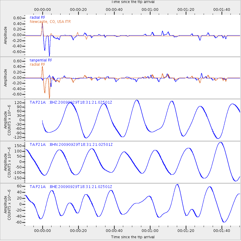
P21A Newcastle, CO, USA - Earthquake Result Viewer
*The percent match for this event was below the threshold and hence no stack was calculated.
| Earthquake location: |
Samoa Islands Region |
| Earthquake latitude/longitude: |
-15.9/-171.7 |
| Earthquake time(UTC): |
2009/09/29 (272) 18:19:35 GMT |
| Earthquake Depth: |
10 km |
| Earthquake Magnitude: |
5.6 MB |
| Earthquake Catalog/Contributor: |
WHDF/NEIC |
|
| Network: |
TA USArray Transportable Network (new EarthScope stations) |
| Station: |
P21A Newcastle, CO, USA |
| Lat/Lon: |
39.52 N/107.45 W |
| Elevation: |
2097 m |
|
| Distance: |
81.3 deg |
| Az: |
44.786 deg |
| Baz: |
241.19 deg |
| Ray Param: |
$rayparam |
*The percent match for this event was below the threshold and hence was not used in the summary stack. |
|
| Radial Match: |
92.48347 % |
| Radial Bump: |
383 |
| Transverse Match: |
68.57998 % |
| Transverse Bump: |
400 |
| SOD ConfigId: |
2622 |
| Insert Time: |
2010-03-06 02:22:38.015 +0000 |
| GWidth: |
2.5 |
| Max Bumps: |
400 |
| Tol: |
0.001 |
|
Signal To Noise
| Channel | StoN | STA | LTA |
| TA:P21A: :BHN:20090929T18:31:21.02501Z | 1.480708 | 1.1505806E-4 | 7.770476E-5 |
| TA:P21A: :BHE:20090929T18:31:21.02501Z | 1.2303591 | 3.322863E-5 | 2.700726E-5 |
| TA:P21A: :BHZ:20090929T18:31:21.02501Z | 1.1281196 | 8.782162E-5 | 7.784779E-5 |
| Arrivals |
| Ps | |
| PpPs | |
| PsPs/PpSs | |


