You are here: Home > Network List > TA - USArray Transportable Network (new EarthScope stations) Stations List
> Station P21A Newcastle, CO, USA > Earthquake Result Viewer
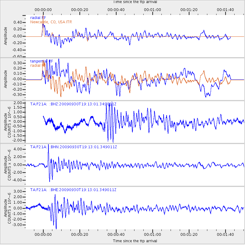
P21A Newcastle, CO, USA - Earthquake Result Viewer
*The percent match for this event was below the threshold and hence no stack was calculated.
| Earthquake location: |
Peru-Bolivia Border Region |
| Earthquake latitude/longitude: |
-15.6/-69.3 |
| Earthquake time(UTC): |
2009/09/30 (273) 19:03:17 GMT |
| Earthquake Depth: |
255 km |
| Earthquake Magnitude: |
5.9 MB, 5.8 MW |
| Earthquake Catalog/Contributor: |
WHDF/NEIC |
|
| Network: |
TA USArray Transportable Network (new EarthScope stations) |
| Station: |
P21A Newcastle, CO, USA |
| Lat/Lon: |
39.52 N/107.45 W |
| Elevation: |
2097 m |
|
| Distance: |
65.3 deg |
| Az: |
328.276 deg |
| Baz: |
139.06 deg |
| Ray Param: |
$rayparam |
*The percent match for this event was below the threshold and hence was not used in the summary stack. |
|
| Radial Match: |
57.2487 % |
| Radial Bump: |
400 |
| Transverse Match: |
45.098316 % |
| Transverse Bump: |
400 |
| SOD ConfigId: |
2622 |
| Insert Time: |
2010-03-06 02:22:39.438 +0000 |
| GWidth: |
2.5 |
| Max Bumps: |
400 |
| Tol: |
0.001 |
|
Signal To Noise
| Channel | StoN | STA | LTA |
| TA:P21A: :BHN:20090930T19:13:01.349011Z | 8.490514 | 1.7689122E-6 | 2.0833981E-7 |
| TA:P21A: :BHE:20090930T19:13:01.349011Z | 2.0559728 | 6.1645756E-7 | 2.998374E-7 |
| TA:P21A: :BHZ:20090930T19:13:01.349011Z | 1.5217243 | 5.6965115E-7 | 3.7434583E-7 |
| Arrivals |
| Ps | |
| PpPs | |
| PsPs/PpSs | |


