You are here: Home > Network List > TA - USArray Transportable Network (new EarthScope stations) Stations List
> Station P21A Newcastle, CO, USA > Earthquake Result Viewer
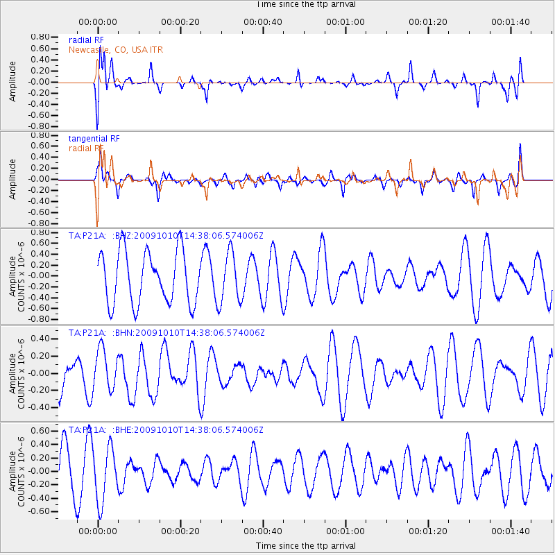
P21A Newcastle, CO, USA - Earthquake Result Viewer
*The percent match for this event was below the threshold and hence no stack was calculated.
| Earthquake location: |
Vanuatu Islands |
| Earthquake latitude/longitude: |
-14.1/166.7 |
| Earthquake time(UTC): |
2009/10/10 (283) 14:25:15 GMT |
| Earthquake Depth: |
35 km |
| Earthquake Magnitude: |
5.6 MB, 5.7 MS, 5.8 MW, 5.8 MW |
| Earthquake Catalog/Contributor: |
WHDF/NEIC |
|
| Network: |
TA USArray Transportable Network (new EarthScope stations) |
| Station: |
P21A Newcastle, CO, USA |
| Lat/Lon: |
39.52 N/107.45 W |
| Elevation: |
2097 m |
|
| Distance: |
95.7 deg |
| Az: |
50.83 deg |
| Baz: |
256.525 deg |
| Ray Param: |
$rayparam |
*The percent match for this event was below the threshold and hence was not used in the summary stack. |
|
| Radial Match: |
70.47194 % |
| Radial Bump: |
373 |
| Transverse Match: |
70.52068 % |
| Transverse Bump: |
329 |
| SOD ConfigId: |
2622 |
| Insert Time: |
2010-03-06 02:22:51.377 +0000 |
| GWidth: |
2.5 |
| Max Bumps: |
400 |
| Tol: |
0.001 |
|
Signal To Noise
| Channel | StoN | STA | LTA |
| TA:P21A: :BHN:20091010T14:38:06.574006Z | 0.9674267 | 2.3554374E-7 | 2.4347452E-7 |
| TA:P21A: :BHE:20091010T14:38:06.574006Z | 1.6827437 | 4.047627E-7 | 2.4053733E-7 |
| TA:P21A: :BHZ:20091010T14:38:06.574006Z | 0.9776804 | 4.672197E-7 | 4.778859E-7 |
| Arrivals |
| Ps | |
| PpPs | |
| PsPs/PpSs | |


