You are here: Home > Network List > TA - USArray Transportable Network (new EarthScope stations) Stations List
> Station P21A Newcastle, CO, USA > Earthquake Result Viewer
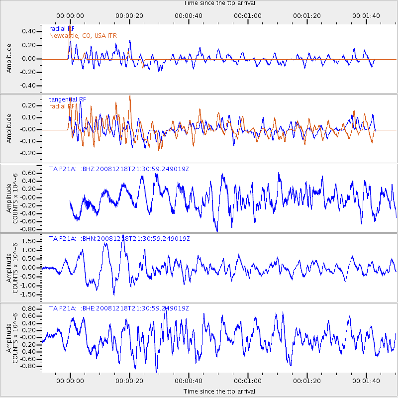
P21A Newcastle, CO, USA - Earthquake Result Viewer
*The percent match for this event was below the threshold and hence no stack was calculated.
| Earthquake location: |
Near Coast Of Central Chile |
| Earthquake latitude/longitude: |
-32.5/-71.7 |
| Earthquake time(UTC): |
2008/12/18 (353) 21:19:28 GMT |
| Earthquake Depth: |
18 km |
| Earthquake Magnitude: |
5.8 MB, 6.0 MS, 6.2 MW, 6.1 MW |
| Earthquake Catalog/Contributor: |
WHDF/NEIC |
|
| Network: |
TA USArray Transportable Network (new EarthScope stations) |
| Station: |
P21A Newcastle, CO, USA |
| Lat/Lon: |
39.52 N/107.45 W |
| Elevation: |
2097 m |
|
| Distance: |
78.9 deg |
| Az: |
332.601 deg |
| Baz: |
149.801 deg |
| Ray Param: |
$rayparam |
*The percent match for this event was below the threshold and hence was not used in the summary stack. |
|
| Radial Match: |
74.57264 % |
| Radial Bump: |
400 |
| Transverse Match: |
40.640404 % |
| Transverse Bump: |
400 |
| SOD ConfigId: |
2658 |
| Insert Time: |
2010-03-06 02:23:04.350 +0000 |
| GWidth: |
2.5 |
| Max Bumps: |
400 |
| Tol: |
0.001 |
|
Signal To Noise
| Channel | StoN | STA | LTA |
| TA:P21A: :BHN:20081218T21:30:59.249019Z | 6.0978427 | 5.1387434E-7 | 8.42715E-8 |
| TA:P21A: :BHE:20081218T21:30:59.249019Z | 1.9370207 | 4.269035E-7 | 2.2039183E-7 |
| TA:P21A: :BHZ:20081218T21:30:59.249019Z | 1.261187 | 3.1240856E-7 | 2.4770995E-7 |
| Arrivals |
| Ps | |
| PpPs | |
| PsPs/PpSs | |


