You are here: Home > Network List > TA - USArray Transportable Network (new EarthScope stations) Stations List
> Station F21K Alatna River, AK, USA > Earthquake Result Viewer
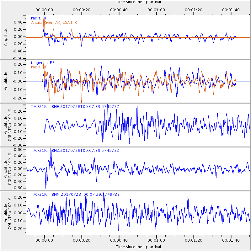
F21K Alatna River, AK, USA - Earthquake Result Viewer
*The percent match for this event was below the threshold and hence no stack was calculated.
| Earthquake location: |
Southeast Of Honshu, Japan |
| Earthquake latitude/longitude: |
29.3/143.0 |
| Earthquake time(UTC): |
2017/07/27 (208) 23:58:52 GMT |
| Earthquake Depth: |
10 km |
| Earthquake Magnitude: |
5.3 Mww |
| Earthquake Catalog/Contributor: |
NEIC PDE/us |
|
| Network: |
TA USArray Transportable Network (new EarthScope stations) |
| Station: |
F21K Alatna River, AK, USA |
| Lat/Lon: |
67.22 N/153.48 W |
| Elevation: |
597 m |
|
| Distance: |
53.2 deg |
| Az: |
25.827 deg |
| Baz: |
257.82 deg |
| Ray Param: |
$rayparam |
*The percent match for this event was below the threshold and hence was not used in the summary stack. |
|
| Radial Match: |
63.133026 % |
| Radial Bump: |
400 |
| Transverse Match: |
50.675945 % |
| Transverse Bump: |
400 |
| SOD ConfigId: |
13570011 |
| Insert Time: |
2019-04-28 11:55:22.551 +0000 |
| GWidth: |
2.5 |
| Max Bumps: |
400 |
| Tol: |
0.001 |
|
Signal To Noise
| Channel | StoN | STA | LTA |
| TA:F21K: :BHZ:20170728T00:07:39.574973Z | 4.8152947 | 2.6241628E-7 | 5.4496407E-8 |
| TA:F21K: :BHN:20170728T00:07:39.574973Z | 1.702686 | 7.3045435E-8 | 4.2900123E-8 |
| TA:F21K: :BHE:20170728T00:07:39.574973Z | 2.8200233 | 1.282846E-7 | 4.5490616E-8 |
| Arrivals |
| Ps | |
| PpPs | |
| PsPs/PpSs | |


