You are here: Home > Network List > TA - USArray Transportable Network (new EarthScope stations) Stations List
> Station P21A Newcastle, CO, USA > Earthquake Result Viewer
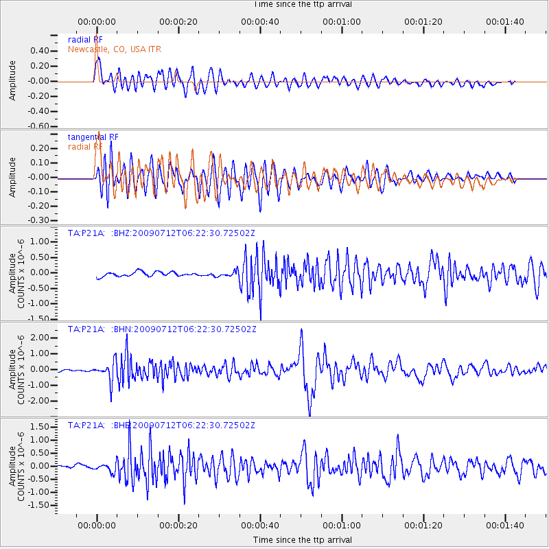
P21A Newcastle, CO, USA - Earthquake Result Viewer
*The percent match for this event was below the threshold and hence no stack was calculated.
| Earthquake location: |
Southern Peru |
| Earthquake latitude/longitude: |
-15.0/-70.4 |
| Earthquake time(UTC): |
2009/07/12 (193) 06:12:47 GMT |
| Earthquake Depth: |
199 km |
| Earthquake Magnitude: |
5.7 MB, 6.1 MW, 6.1 MW |
| Earthquake Catalog/Contributor: |
WHDF/NEIC |
|
| Network: |
TA USArray Transportable Network (new EarthScope stations) |
| Station: |
P21A Newcastle, CO, USA |
| Lat/Lon: |
39.52 N/107.45 W |
| Elevation: |
2097 m |
|
| Distance: |
64.3 deg |
| Az: |
328.9 deg |
| Baz: |
139.816 deg |
| Ray Param: |
$rayparam |
*The percent match for this event was below the threshold and hence was not used in the summary stack. |
|
| Radial Match: |
77.900795 % |
| Radial Bump: |
400 |
| Transverse Match: |
68.61279 % |
| Transverse Bump: |
400 |
| SOD ConfigId: |
2648 |
| Insert Time: |
2010-03-06 02:23:11.438 +0000 |
| GWidth: |
2.5 |
| Max Bumps: |
400 |
| Tol: |
0.001 |
|
Signal To Noise
| Channel | StoN | STA | LTA |
| TA:P21A: :BHN:20090712T06:22:30.72502Z | 9.342933 | 6.1297044E-7 | 6.560793E-8 |
| TA:P21A: :BHE:20090712T06:22:30.72502Z | 3.2619927 | 1.5918341E-7 | 4.879944E-8 |
| TA:P21A: :BHZ:20090712T06:22:30.72502Z | 1.2233078 | 8.75169E-8 | 7.1541194E-8 |
| Arrivals |
| Ps | |
| PpPs | |
| PsPs/PpSs | |


