You are here: Home > Network List > TA - USArray Transportable Network (new EarthScope stations) Stations List
> Station P21A Newcastle, CO, USA > Earthquake Result Viewer
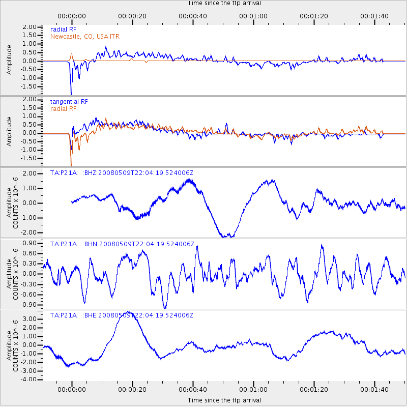
P21A Newcastle, CO, USA - Earthquake Result Viewer
*The percent match for this event was below the threshold and hence no stack was calculated.
| Earthquake location: |
South Of Mariana Islands |
| Earthquake latitude/longitude: |
12.5/143.2 |
| Earthquake time(UTC): |
2008/05/09 (130) 21:51:29 GMT |
| Earthquake Depth: |
76 km |
| Earthquake Magnitude: |
6.1 MB, 6.7 MW, 6.7 MW |
| Earthquake Catalog/Contributor: |
WHDF/NEIC |
|
| Network: |
TA USArray Transportable Network (new EarthScope stations) |
| Station: |
P21A Newcastle, CO, USA |
| Lat/Lon: |
39.52 N/107.45 W |
| Elevation: |
2097 m |
|
| Distance: |
96.5 deg |
| Az: |
47.262 deg |
| Baz: |
291.98 deg |
| Ray Param: |
$rayparam |
*The percent match for this event was below the threshold and hence was not used in the summary stack. |
|
| Radial Match: |
52.349346 % |
| Radial Bump: |
400 |
| Transverse Match: |
41.78117 % |
| Transverse Bump: |
400 |
| SOD ConfigId: |
2504 |
| Insert Time: |
2010-03-06 02:23:22.798 +0000 |
| GWidth: |
2.5 |
| Max Bumps: |
400 |
| Tol: |
0.001 |
|
Signal To Noise
| Channel | StoN | STA | LTA |
| TA:P21A: :BHN:20080509T22:04:19.524006Z | 1.9025257 | 3.7388696E-7 | 1.9652138E-7 |
| TA:P21A: :BHE:20080509T22:04:19.524006Z | 4.263594 | 2.5041004E-6 | 5.873215E-7 |
| TA:P21A: :BHZ:20080509T22:04:19.524006Z | 1.3506042 | 7.049535E-7 | 5.219542E-7 |
| Arrivals |
| Ps | |
| PpPs | |
| PsPs/PpSs | |


