You are here: Home > Network List > TA - USArray Transportable Network (new EarthScope stations) Stations List
> Station M31M Drury Creek, Yukon, CA > Earthquake Result Viewer
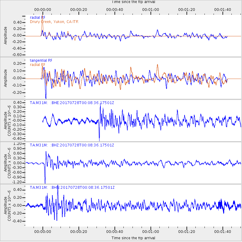
M31M Drury Creek, Yukon, CA - Earthquake Result Viewer
*The percent match for this event was below the threshold and hence no stack was calculated.
| Earthquake location: |
Southeast Of Honshu, Japan |
| Earthquake latitude/longitude: |
29.3/143.0 |
| Earthquake time(UTC): |
2017/07/27 (208) 23:58:52 GMT |
| Earthquake Depth: |
10 km |
| Earthquake Magnitude: |
5.3 Mww |
| Earthquake Catalog/Contributor: |
NEIC PDE/us |
|
| Network: |
TA USArray Transportable Network (new EarthScope stations) |
| Station: |
M31M Drury Creek, Yukon, CA |
| Lat/Lon: |
62.20 N/134.39 W |
| Elevation: |
639 m |
|
| Distance: |
61.2 deg |
| Az: |
32.054 deg |
| Baz: |
278.495 deg |
| Ray Param: |
$rayparam |
*The percent match for this event was below the threshold and hence was not used in the summary stack. |
|
| Radial Match: |
54.524315 % |
| Radial Bump: |
400 |
| Transverse Match: |
69.2126 % |
| Transverse Bump: |
400 |
| SOD ConfigId: |
13570011 |
| Insert Time: |
2019-04-28 11:56:23.837 +0000 |
| GWidth: |
2.5 |
| Max Bumps: |
400 |
| Tol: |
0.001 |
|
Signal To Noise
| Channel | StoN | STA | LTA |
| TA:M31M: :BHZ:20170728T00:08:36.17501Z | 10.0734005 | 3.9966844E-7 | 3.9675626E-8 |
| TA:M31M: :BHN:20170728T00:08:36.17501Z | 4.5746074 | 1.2312518E-7 | 2.6914915E-8 |
| TA:M31M: :BHE:20170728T00:08:36.17501Z | 3.0012357 | 1.552978E-7 | 5.174462E-8 |
| Arrivals |
| Ps | |
| PpPs | |
| PsPs/PpSs | |


