You are here: Home > Network List > TA - USArray Transportable Network (new EarthScope stations) Stations List
> Station O28M Mount Upton, YT, CAN > Earthquake Result Viewer
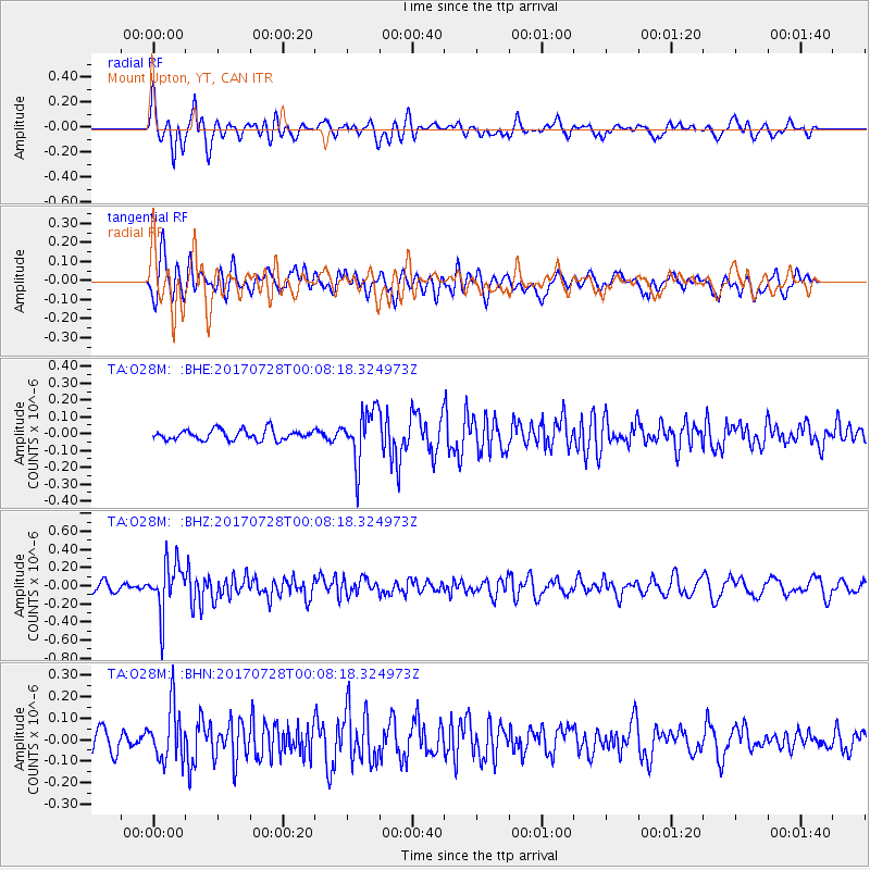
O28M Mount Upton, YT, CAN - Earthquake Result Viewer
*The percent match for this event was below the threshold and hence no stack was calculated.
| Earthquake location: |
Southeast Of Honshu, Japan |
| Earthquake latitude/longitude: |
29.3/143.0 |
| Earthquake time(UTC): |
2017/07/27 (208) 23:58:52 GMT |
| Earthquake Depth: |
10 km |
| Earthquake Magnitude: |
5.3 Mww |
| Earthquake Catalog/Contributor: |
NEIC PDE/us |
|
| Network: |
TA USArray Transportable Network (new EarthScope stations) |
| Station: |
O28M Mount Upton, YT, CAN |
| Lat/Lon: |
60.77 N/140.19 W |
| Elevation: |
2622 m |
|
| Distance: |
58.6 deg |
| Az: |
34.063 deg |
| Baz: |
274.414 deg |
| Ray Param: |
$rayparam |
*The percent match for this event was below the threshold and hence was not used in the summary stack. |
|
| Radial Match: |
62.019855 % |
| Radial Bump: |
400 |
| Transverse Match: |
50.698055 % |
| Transverse Bump: |
400 |
| SOD ConfigId: |
13570011 |
| Insert Time: |
2019-04-28 11:56:39.409 +0000 |
| GWidth: |
2.5 |
| Max Bumps: |
400 |
| Tol: |
0.001 |
|
Signal To Noise
| Channel | StoN | STA | LTA |
| TA:O28M: :BHZ:20170728T00:08:18.324973Z | 5.2944884 | 2.7521696E-7 | 5.1981786E-8 |
| TA:O28M: :BHN:20170728T00:08:18.324973Z | 2.494345 | 1.2442162E-7 | 4.9881482E-8 |
| TA:O28M: :BHE:20170728T00:08:18.324973Z | 5.046722 | 1.5538384E-7 | 3.0789064E-8 |
| Arrivals |
| Ps | |
| PpPs | |
| PsPs/PpSs | |


