You are here: Home > Network List > TA - USArray Transportable Network (new EarthScope stations) Stations List
> Station R32K Eaglecrest, AK, USA > Earthquake Result Viewer
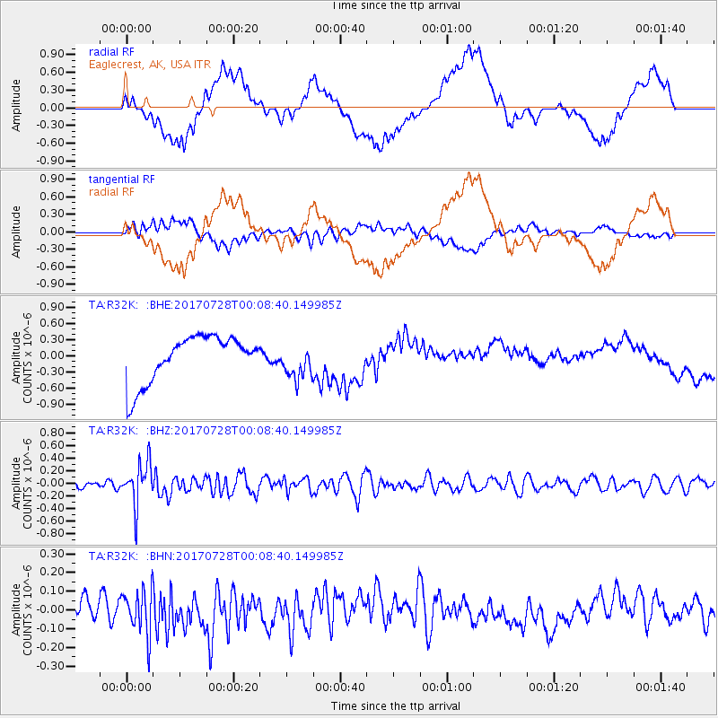
R32K Eaglecrest, AK, USA - Earthquake Result Viewer
*The percent match for this event was below the threshold and hence no stack was calculated.
| Earthquake location: |
Southeast Of Honshu, Japan |
| Earthquake latitude/longitude: |
29.3/143.0 |
| Earthquake time(UTC): |
2017/07/27 (208) 23:58:52 GMT |
| Earthquake Depth: |
10 km |
| Earthquake Magnitude: |
5.3 Mww |
| Earthquake Catalog/Contributor: |
NEIC PDE/us |
|
| Network: |
TA USArray Transportable Network (new EarthScope stations) |
| Station: |
R32K Eaglecrest, AK, USA |
| Lat/Lon: |
58.27 N/134.52 W |
| Elevation: |
386 m |
|
| Distance: |
61.8 deg |
| Az: |
36.49 deg |
| Baz: |
280.504 deg |
| Ray Param: |
$rayparam |
*The percent match for this event was below the threshold and hence was not used in the summary stack. |
|
| Radial Match: |
29.211678 % |
| Radial Bump: |
400 |
| Transverse Match: |
34.458668 % |
| Transverse Bump: |
400 |
| SOD ConfigId: |
13570011 |
| Insert Time: |
2019-04-28 11:56:55.103 +0000 |
| GWidth: |
2.5 |
| Max Bumps: |
400 |
| Tol: |
0.001 |
|
Signal To Noise
| Channel | StoN | STA | LTA |
| TA:R32K: :BHZ:20170728T00:08:40.149985Z | 6.1849437 | 3.387961E-7 | 5.4777555E-8 |
| TA:R32K: :BHN:20170728T00:08:40.149985Z | 1.4019355 | 1.1845231E-7 | 8.449199E-8 |
| TA:R32K: :BHE:20170728T00:08:40.149985Z | 0.8032437 | 3.4134806E-7 | 4.24962E-7 |
| Arrivals |
| Ps | |
| PpPs | |
| PsPs/PpSs | |


