You are here: Home > Network List > TJ - Tajikistan National Seismic Network Stations List
> Station GARM Garm, Tajikistan > Earthquake Result Viewer
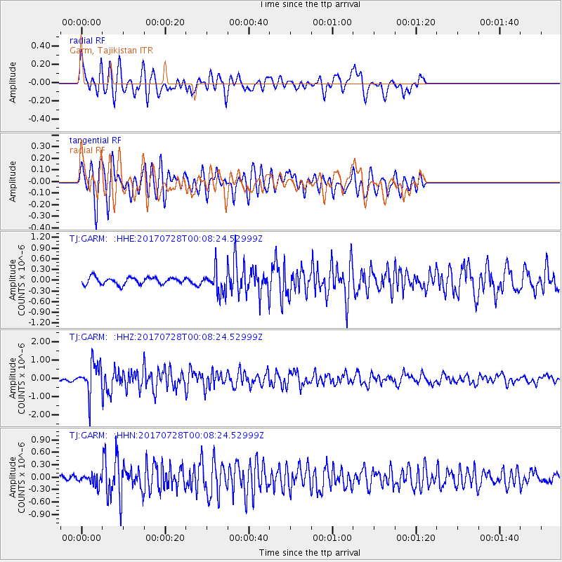
GARM Garm, Tajikistan - Earthquake Result Viewer
*The percent match for this event was below the threshold and hence no stack was calculated.
| Earthquake location: |
Southeast Of Honshu, Japan |
| Earthquake latitude/longitude: |
29.3/143.0 |
| Earthquake time(UTC): |
2017/07/27 (208) 23:58:52 GMT |
| Earthquake Depth: |
10 km |
| Earthquake Magnitude: |
5.3 Mww |
| Earthquake Catalog/Contributor: |
NEIC PDE/us |
|
| Network: |
TJ Tajikistan National Seismic Network |
| Station: |
GARM Garm, Tajikistan |
| Lat/Lon: |
39.00 N/70.32 E |
| Elevation: |
1305 m |
|
| Distance: |
59.5 deg |
| Az: |
300.292 deg |
| Baz: |
75.493 deg |
| Ray Param: |
$rayparam |
*The percent match for this event was below the threshold and hence was not used in the summary stack. |
|
| Radial Match: |
71.14272 % |
| Radial Bump: |
400 |
| Transverse Match: |
75.865326 % |
| Transverse Bump: |
400 |
| SOD ConfigId: |
13570011 |
| Insert Time: |
2019-04-28 11:57:13.249 +0000 |
| GWidth: |
2.5 |
| Max Bumps: |
400 |
| Tol: |
0.001 |
|
Signal To Noise
| Channel | StoN | STA | LTA |
| TJ:GARM: :HHZ:20170728T00:08:24.52999Z | 8.275117 | 8.872121E-7 | 1.0721445E-7 |
| TJ:GARM: :HHN:20170728T00:08:24.52999Z | 1.0846523 | 1.2536022E-7 | 1.1557641E-7 |
| TJ:GARM: :HHE:20170728T00:08:24.52999Z | 3.6929004 | 3.6286895E-7 | 9.826123E-8 |
| Arrivals |
| Ps | |
| PpPs | |
| PsPs/PpSs | |


