You are here: Home > Network List > US - United States National Seismic Network Stations List
> Station AMTX Amarillo, Texas, USA > Earthquake Result Viewer
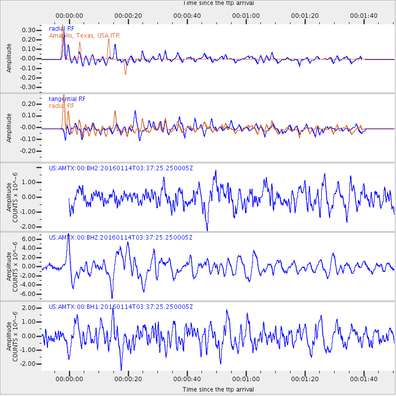
AMTX Amarillo, Texas, USA - Earthquake Result Viewer
*The percent match for this event was below the threshold and hence no stack was calculated.
| Earthquake location: |
Hokkaido, Japan Region |
| Earthquake latitude/longitude: |
42.0/142.7 |
| Earthquake time(UTC): |
2016/01/14 (014) 03:25:34 GMT |
| Earthquake Depth: |
51 km |
| Earthquake Magnitude: |
6.7 MWP, 6.7 MI |
| Earthquake Catalog/Contributor: |
NEIC PDE/NEIC COMCAT |
|
| Network: |
US United States National Seismic Network |
| Station: |
AMTX Amarillo, Texas, USA |
| Lat/Lon: |
34.53 N/101.41 W |
| Elevation: |
1010 m |
|
| Distance: |
83.9 deg |
| Az: |
48.344 deg |
| Baz: |
317.541 deg |
| Ray Param: |
$rayparam |
*The percent match for this event was below the threshold and hence was not used in the summary stack. |
|
| Radial Match: |
62.052883 % |
| Radial Bump: |
332 |
| Transverse Match: |
59.428356 % |
| Transverse Bump: |
400 |
| SOD ConfigId: |
1399611 |
| Insert Time: |
2016-01-28 04:34:24.580 +0000 |
| GWidth: |
2.5 |
| Max Bumps: |
400 |
| Tol: |
0.001 |
|
Signal To Noise
| Channel | StoN | STA | LTA |
| US:AMTX:00:BHZ:20160114T03:37:25.250005Z | 9.724533 | 3.203438E-6 | 3.2941816E-7 |
| US:AMTX:00:BH1:20160114T03:37:25.250005Z | 1.6755699 | 8.8344495E-7 | 5.2725045E-7 |
| US:AMTX:00:BH2:20160114T03:37:25.250005Z | 1.9345701 | 6.1413056E-7 | 3.1745066E-7 |
| Arrivals |
| Ps | |
| PpPs | |
| PsPs/PpSs | |


