You are here: Home > Network List > TA - USArray Transportable Network (new EarthScope stations) Stations List
> Station I25A Rochford, SD, USA > Earthquake Result Viewer
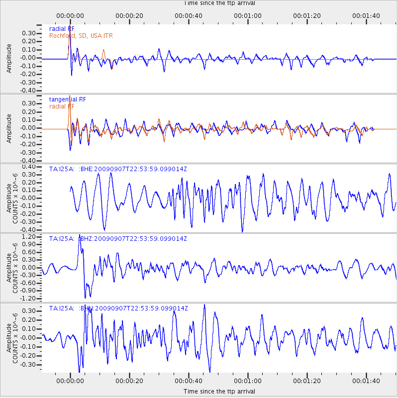
I25A Rochford, SD, USA - Earthquake Result Viewer
*The percent match for this event was below the threshold and hence no stack was calculated.
| Earthquake location: |
Northwestern Caucasus |
| Earthquake latitude/longitude: |
42.7/43.4 |
| Earthquake time(UTC): |
2009/09/07 (250) 22:41:37 GMT |
| Earthquake Depth: |
15 km |
| Earthquake Magnitude: |
5.7 MB, 5.8 MS, 6.0 MW, 5.9 MW |
| Earthquake Catalog/Contributor: |
WHDF/NEIC |
|
| Network: |
TA USArray Transportable Network (new EarthScope stations) |
| Station: |
I25A Rochford, SD, USA |
| Lat/Lon: |
44.02 N/103.73 W |
| Elevation: |
1856 m |
|
| Distance: |
88.8 deg |
| Az: |
336.974 deg |
| Baz: |
23.574 deg |
| Ray Param: |
$rayparam |
*The percent match for this event was below the threshold and hence was not used in the summary stack. |
|
| Radial Match: |
74.29181 % |
| Radial Bump: |
400 |
| Transverse Match: |
55.80661 % |
| Transverse Bump: |
400 |
| SOD ConfigId: |
2622 |
| Insert Time: |
2010-03-06 02:24:01.809 +0000 |
| GWidth: |
2.5 |
| Max Bumps: |
400 |
| Tol: |
0.001 |
|
Signal To Noise
| Channel | StoN | STA | LTA |
| TA:I25A: :BHZ:20090907T22:53:59.099014Z | 4.011727 | 5.204153E-7 | 1.2972353E-7 |
| TA:I25A: :BHN:20090907T22:53:59.099014Z | 1.7961564 | 1.5435991E-7 | 8.5939014E-8 |
| TA:I25A: :BHE:20090907T22:53:59.099014Z | 0.47080967 | 7.7493205E-8 | 1.6459562E-7 |
| Arrivals |
| Ps | |
| PpPs | |
| PsPs/PpSs | |


