You are here: Home > Network List > TA - USArray Transportable Network (new EarthScope stations) Stations List
> Station I25A Rochford, SD, USA > Earthquake Result Viewer
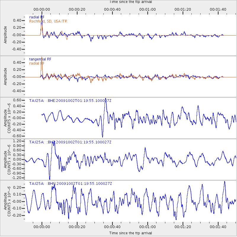
I25A Rochford, SD, USA - Earthquake Result Viewer
*The percent match for this event was below the threshold and hence no stack was calculated.
| Earthquake location: |
Tonga Islands |
| Earthquake latitude/longitude: |
-16.3/-173.5 |
| Earthquake time(UTC): |
2009/10/02 (275) 01:07:39 GMT |
| Earthquake Depth: |
8.0 km |
| Earthquake Magnitude: |
6.1 MB, 6.0 MS, 6.1 MW, 6.1 MW |
| Earthquake Catalog/Contributor: |
WHDF/NEIC |
|
| Network: |
TA USArray Transportable Network (new EarthScope stations) |
| Station: |
I25A Rochford, SD, USA |
| Lat/Lon: |
44.02 N/103.73 W |
| Elevation: |
1856 m |
|
| Distance: |
87.3 deg |
| Az: |
42.65 deg |
| Baz: |
244.382 deg |
| Ray Param: |
$rayparam |
*The percent match for this event was below the threshold and hence was not used in the summary stack. |
|
| Radial Match: |
74.70878 % |
| Radial Bump: |
339 |
| Transverse Match: |
70.8246 % |
| Transverse Bump: |
400 |
| SOD ConfigId: |
2622 |
| Insert Time: |
2010-03-06 02:24:04.273 +0000 |
| GWidth: |
2.5 |
| Max Bumps: |
400 |
| Tol: |
0.001 |
|
Signal To Noise
| Channel | StoN | STA | LTA |
| TA:I25A: :BHZ:20091002T01:19:55.100027Z | 3.9454675 | 4.7650428E-7 | 1.2077258E-7 |
| TA:I25A: :BHN:20091002T01:19:55.100027Z | 0.9351365 | 7.538211E-8 | 8.061081E-8 |
| TA:I25A: :BHE:20091002T01:19:55.100027Z | 2.3732479 | 2.4653437E-7 | 1.0388059E-7 |
| Arrivals |
| Ps | |
| PpPs | |
| PsPs/PpSs | |


