You are here: Home > Network List > US - United States National Seismic Network Stations List
> Station ERPA Erie, Pennsylvania, USA > Earthquake Result Viewer
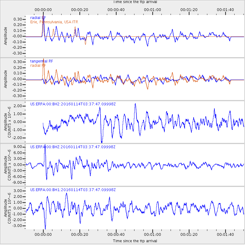
ERPA Erie, Pennsylvania, USA - Earthquake Result Viewer
*The percent match for this event was below the threshold and hence no stack was calculated.
| Earthquake location: |
Hokkaido, Japan Region |
| Earthquake latitude/longitude: |
42.0/142.7 |
| Earthquake time(UTC): |
2016/01/14 (014) 03:25:34 GMT |
| Earthquake Depth: |
51 km |
| Earthquake Magnitude: |
6.7 MWP, 6.7 MI |
| Earthquake Catalog/Contributor: |
NEIC PDE/NEIC COMCAT |
|
| Network: |
US United States National Seismic Network |
| Station: |
ERPA Erie, Pennsylvania, USA |
| Lat/Lon: |
42.12 N/79.99 W |
| Elevation: |
306 m |
|
| Distance: |
87.9 deg |
| Az: |
30.331 deg |
| Baz: |
329.582 deg |
| Ray Param: |
$rayparam |
*The percent match for this event was below the threshold and hence was not used in the summary stack. |
|
| Radial Match: |
51.98789 % |
| Radial Bump: |
400 |
| Transverse Match: |
59.561752 % |
| Transverse Bump: |
400 |
| SOD ConfigId: |
1399611 |
| Insert Time: |
2016-01-28 04:35:33.489 +0000 |
| GWidth: |
2.5 |
| Max Bumps: |
400 |
| Tol: |
0.001 |
|
Signal To Noise
| Channel | StoN | STA | LTA |
| US:ERPA:00:BHZ:20160114T03:37:47.09998Z | 5.425361 | 3.796784E-6 | 6.9982144E-7 |
| US:ERPA:00:BH1:20160114T03:37:47.09998Z | 1.8339503 | 1.4269127E-6 | 7.780542E-7 |
| US:ERPA:00:BH2:20160114T03:37:47.09998Z | 1.926436 | 1.2760721E-6 | 6.6240045E-7 |
| Arrivals |
| Ps | |
| PpPs | |
| PsPs/PpSs | |


