You are here: Home > Network List > TA - USArray Transportable Network (new EarthScope stations) Stations List
> Station H27A Howes, SD, USA > Earthquake Result Viewer
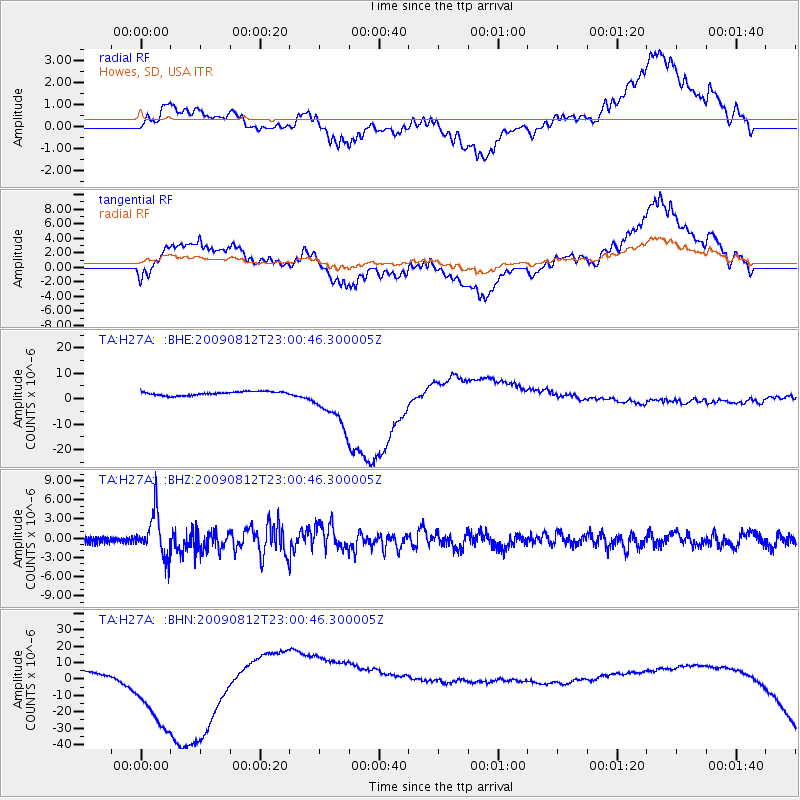
H27A Howes, SD, USA - Earthquake Result Viewer
*The percent match for this event was below the threshold and hence no stack was calculated.
| Earthquake location: |
Southeast Of Honshu, Japan |
| Earthquake latitude/longitude: |
32.8/140.4 |
| Earthquake time(UTC): |
2009/08/12 (224) 22:48:51 GMT |
| Earthquake Depth: |
53 km |
| Earthquake Magnitude: |
6.2 MB, 6.6 MW, 6.6 MW |
| Earthquake Catalog/Contributor: |
WHDF/NEIC |
|
| Network: |
TA USArray Transportable Network (new EarthScope stations) |
| Station: |
H27A Howes, SD, USA |
| Lat/Lon: |
44.63 N/102.08 W |
| Elevation: |
748 m |
|
| Distance: |
84.3 deg |
| Az: |
39.519 deg |
| Baz: |
311.371 deg |
| Ray Param: |
$rayparam |
*The percent match for this event was below the threshold and hence was not used in the summary stack. |
|
| Radial Match: |
46.561428 % |
| Radial Bump: |
400 |
| Transverse Match: |
45.181557 % |
| Transverse Bump: |
400 |
| SOD ConfigId: |
2622 |
| Insert Time: |
2010-03-06 02:24:31.538 +0000 |
| GWidth: |
2.5 |
| Max Bumps: |
400 |
| Tol: |
0.001 |
|
Signal To Noise
| Channel | StoN | STA | LTA |
| TA:H27A: :BHZ:20090812T23:00:46.300005Z | 7.355839 | 3.3104432E-6 | 4.500429E-7 |
| TA:H27A: :BHN:20090812T23:00:46.300005Z | 14.428176 | 2.6877238E-5 | 1.86283E-6 |
| TA:H27A: :BHE:20090812T23:00:46.300005Z | 13.591559 | 9.474428E-6 | 6.9708176E-7 |
| Arrivals |
| Ps | |
| PpPs | |
| PsPs/PpSs | |


