You are here: Home > Network List > TA - USArray Transportable Network (new EarthScope stations) Stations List
> Station MSTX Muleshoe, TX, USA > Earthquake Result Viewer
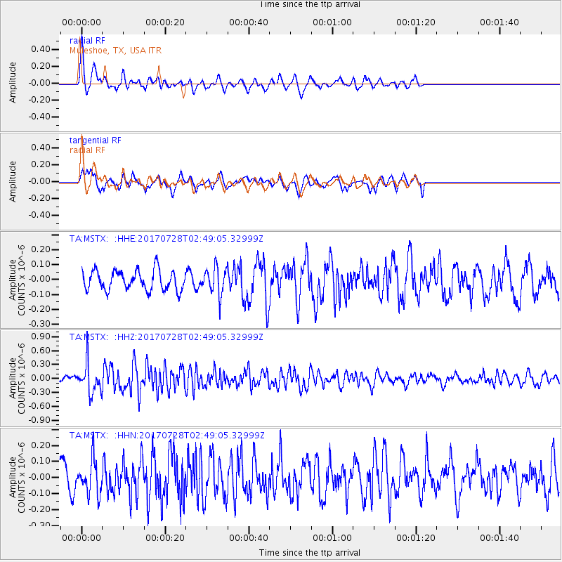
MSTX Muleshoe, TX, USA - Earthquake Result Viewer
*The percent match for this event was below the threshold and hence no stack was calculated.
| Earthquake location: |
Komandorskiye Ostrova Region |
| Earthquake latitude/longitude: |
54.3/169.3 |
| Earthquake time(UTC): |
2017/07/28 (209) 02:39:16 GMT |
| Earthquake Depth: |
10 km |
| Earthquake Magnitude: |
5.5 mb |
| Earthquake Catalog/Contributor: |
NEIC PDE/us |
|
| Network: |
TA USArray Transportable Network (new EarthScope stations) |
| Station: |
MSTX Muleshoe, TX, USA |
| Lat/Lon: |
33.97 N/102.77 W |
| Elevation: |
1167 m |
|
| Distance: |
62.1 deg |
| Az: |
70.039 deg |
| Baz: |
318.517 deg |
| Ray Param: |
$rayparam |
*The percent match for this event was below the threshold and hence was not used in the summary stack. |
|
| Radial Match: |
55.87231 % |
| Radial Bump: |
374 |
| Transverse Match: |
68.14777 % |
| Transverse Bump: |
400 |
| SOD ConfigId: |
13570011 |
| Insert Time: |
2019-04-28 12:06:17.145 +0000 |
| GWidth: |
2.5 |
| Max Bumps: |
400 |
| Tol: |
0.001 |
|
Signal To Noise
| Channel | StoN | STA | LTA |
| TA:MSTX: :HHZ:20170728T02:49:05.32999Z | 3.3471618 | 3.2810917E-7 | 9.8026085E-8 |
| TA:MSTX: :HHN:20170728T02:49:05.32999Z | 1.0479958 | 1.06385386E-7 | 1.0151317E-7 |
| TA:MSTX: :HHE:20170728T02:49:05.32999Z | 1.4272447 | 9.4041326E-8 | 6.589013E-8 |
| Arrivals |
| Ps | |
| PpPs | |
| PsPs/PpSs | |


