G28A Parade, SD, USA - Earthquake Result Viewer
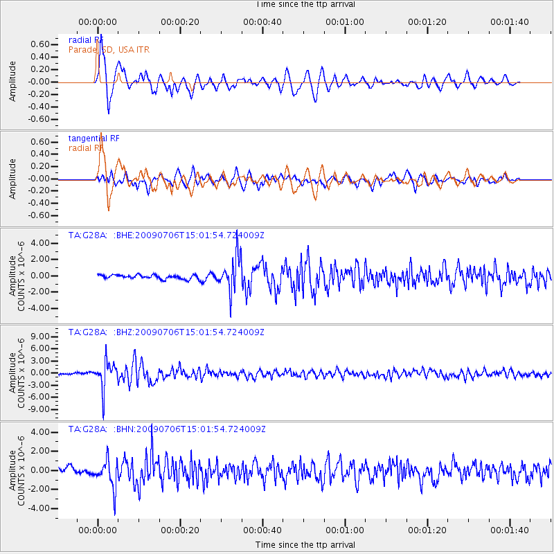
Earthquake location: Rat Islands, Aleutian Islands
Earthquake latitude/longitude: 50.4/177.0
Earthquake time(UTC): 2009/07/06 (187) 14:53:12 GMT
Earthquake Depth: 22 km
Earthquake Magnitude: 6.0 MB, 5.8 MS, 6.1 MW, 6.0 MW
Earthquake Catalog/Contributor: WHDF/NEIC
Network: TA USArray Transportable Network (new EarthScope stations)
Station: G28A Parade, SD, USA
Lat/Lon: 45.07 N/100.92 W
Elevation: 709 m
Distance: 52.8 deg
Az: 61.8 deg
Baz: 307.307 deg
Ray Param: 0.0665086
Estimated Moho Depth: 17.0 km
Estimated Crust Vp/Vs: 1.60
Assumed Crust Vp: 6.53 km/s
Estimated Crust Vs: 4.082 km/s
Estimated Crust Poisson's Ratio: 0.18
Radial Match: 87.18498 %
Radial Bump: 400
Transverse Match: 65.45173 %
Transverse Bump: 400
SOD ConfigId: 2648
Insert Time: 2010-03-06 02:25:06.066 +0000
GWidth: 2.5
Max Bumps: 400
Tol: 0.001

Signal To Noise

ChannelStoNSTALTA
TA:G28A: :BHZ:20090706T15:01:54.724009Z21.8838023.3734957E-61.5415492E-7
TA:G28A: :BHN:20090706T15:01:54.724009Z5.09559971.4677752E-62.880476E-7
TA:G28A: :BHE:20090706T15:01:54.724009Z8.62592.1574494E-62.5011295E-7
Arrivals
Ps1.7 SECOND
PpPs6.4 SECOND
PsPs/PpSs8.0 SECOND