You are here: Home > Network List > US - United States National Seismic Network Stations List
> Station WMOK Wichita Mountains, Oklahoma, USA > Earthquake Result Viewer
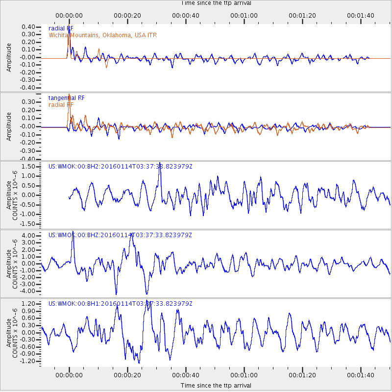
WMOK Wichita Mountains, Oklahoma, USA - Earthquake Result Viewer
*The percent match for this event was below the threshold and hence no stack was calculated.
| Earthquake location: |
Hokkaido, Japan Region |
| Earthquake latitude/longitude: |
42.0/142.7 |
| Earthquake time(UTC): |
2016/01/14 (014) 03:25:34 GMT |
| Earthquake Depth: |
51 km |
| Earthquake Magnitude: |
6.7 MWP, 6.7 MI |
| Earthquake Catalog/Contributor: |
NEIC PDE/NEIC COMCAT |
|
| Network: |
US United States National Seismic Network |
| Station: |
WMOK Wichita Mountains, Oklahoma, USA |
| Lat/Lon: |
34.74 N/98.78 W |
| Elevation: |
486 m |
|
| Distance: |
85.1 deg |
| Az: |
46.583 deg |
| Baz: |
318.859 deg |
| Ray Param: |
$rayparam |
*The percent match for this event was below the threshold and hence was not used in the summary stack. |
|
| Radial Match: |
66.69063 % |
| Radial Bump: |
400 |
| Transverse Match: |
61.015797 % |
| Transverse Bump: |
400 |
| SOD ConfigId: |
1399611 |
| Insert Time: |
2016-01-28 04:37:59.008 +0000 |
| GWidth: |
2.5 |
| Max Bumps: |
400 |
| Tol: |
0.001 |
|
Signal To Noise
| Channel | StoN | STA | LTA |
| US:WMOK:00:BHZ:20160114T03:37:33.823979Z | 3.1669326 | 1.6811133E-6 | 5.308333E-7 |
| US:WMOK:00:BH1:20160114T03:37:33.823979Z | 1.1813525 | 3.7907182E-7 | 3.208795E-7 |
| US:WMOK:00:BH2:20160114T03:37:33.823979Z | 1.8680842 | 6.306939E-7 | 3.3761535E-7 |
| Arrivals |
| Ps | |
| PpPs | |
| PsPs/PpSs | |


