You are here: Home > Network List > AV - Alaska Volcano Observatory Stations List
> Station SPCR Ckakachatna River, Mount Spurr, Alaska > Earthquake Result Viewer
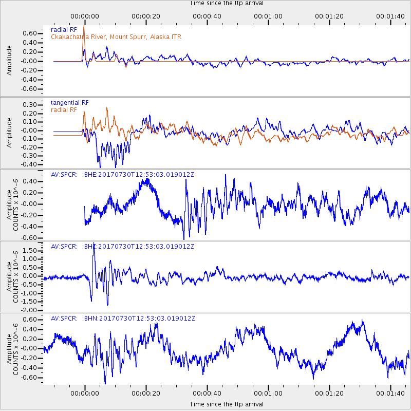
SPCR Ckakachatna River, Mount Spurr, Alaska - Earthquake Result Viewer
*The percent match for this event was below the threshold and hence no stack was calculated.
| Earthquake location: |
Off East Coast Of Honshu, Japan |
| Earthquake latitude/longitude: |
36.3/143.7 |
| Earthquake time(UTC): |
2017/07/30 (211) 12:45:06 GMT |
| Earthquake Depth: |
17 km |
| Earthquake Magnitude: |
5.3 Mww |
| Earthquake Catalog/Contributor: |
NEIC PDE/us |
|
| Network: |
AV Alaska Volcano Observatory |
| Station: |
SPCR Ckakachatna River, Mount Spurr, Alaska |
| Lat/Lon: |
61.20 N/152.21 W |
| Elevation: |
984 m |
|
| Distance: |
46.6 deg |
| Az: |
36.804 deg |
| Baz: |
268.147 deg |
| Ray Param: |
$rayparam |
*The percent match for this event was below the threshold and hence was not used in the summary stack. |
|
| Radial Match: |
44.218994 % |
| Radial Bump: |
400 |
| Transverse Match: |
77.77738 % |
| Transverse Bump: |
400 |
| SOD ConfigId: |
13570011 |
| Insert Time: |
2019-04-28 12:10:10.792 +0000 |
| GWidth: |
2.5 |
| Max Bumps: |
400 |
| Tol: |
0.001 |
|
Signal To Noise
| Channel | StoN | STA | LTA |
| AV:SPCR: :BHZ:20170730T12:53:03.019012Z | 10.004464 | 7.4141843E-7 | 7.410876E-8 |
| AV:SPCR: :BHN:20170730T12:53:03.019012Z | 1.0128931 | 1.8046434E-7 | 1.7816723E-7 |
| AV:SPCR: :BHE:20170730T12:53:03.019012Z | 1.7232773 | 3.4717127E-7 | 2.014599E-7 |
| Arrivals |
| Ps | |
| PpPs | |
| PsPs/PpSs | |


