H28A Mission Ridge, SD, USA - Earthquake Result Viewer
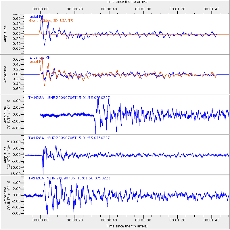
Earthquake location: Rat Islands, Aleutian Islands
Earthquake latitude/longitude: 50.4/177.0
Earthquake time(UTC): 2009/07/06 (187) 14:53:12 GMT
Earthquake Depth: 22 km
Earthquake Magnitude: 6.0 MB, 5.8 MS, 6.1 MW, 6.0 MW
Earthquake Catalog/Contributor: WHDF/NEIC
Network: TA USArray Transportable Network (new EarthScope stations)
Station: H28A Mission Ridge, SD, USA
Lat/Lon: 44.68 N/101.02 W
Elevation: 642 m
Distance: 53.0 deg
Az: 62.255 deg
Baz: 307.508 deg
Ray Param: 0.066385396
Estimated Moho Depth: 12.25 km
Estimated Crust Vp/Vs: 1.60
Assumed Crust Vp: 6.53 km/s
Estimated Crust Vs: 4.082 km/s
Estimated Crust Poisson's Ratio: 0.18
Radial Match: 95.21652 %
Radial Bump: 400
Transverse Match: 88.293594 %
Transverse Bump: 400
SOD ConfigId: 2648
Insert Time: 2010-03-06 02:25:37.719 +0000
GWidth: 2.5
Max Bumps: 400
Tol: 0.001

Signal To Noise

ChannelStoNSTALTA
TA:H28A: :BHZ:20090706T15:01:56.075022Z23.7898274.3546797E-61.8304797E-7
TA:H28A: :BHN:20090706T15:01:56.075022Z7.9194322.271576E-62.8683573E-7
TA:H28A: :BHE:20090706T15:01:56.075022Z8.3722042.1283015E-62.5421042E-7
Arrivals
Ps1.2 SECOND
PpPs4.6 SECOND
PsPs/PpSs5.8 SECOND