You are here: Home > Network List > TA - USArray Transportable Network (new EarthScope stations) Stations List
> Station 121A Cookes Peak, Deming, NM, USA > Earthquake Result Viewer
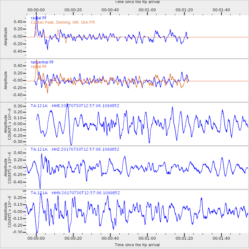
121A Cookes Peak, Deming, NM, USA - Earthquake Result Viewer
*The percent match for this event was below the threshold and hence no stack was calculated.
| Earthquake location: |
Off East Coast Of Honshu, Japan |
| Earthquake latitude/longitude: |
36.3/143.7 |
| Earthquake time(UTC): |
2017/07/30 (211) 12:45:06 GMT |
| Earthquake Depth: |
17 km |
| Earthquake Magnitude: |
5.3 Mww |
| Earthquake Catalog/Contributor: |
NEIC PDE/us |
|
| Network: |
TA USArray Transportable Network (new EarthScope stations) |
| Station: |
121A Cookes Peak, Deming, NM, USA |
| Lat/Lon: |
32.53 N/107.79 W |
| Elevation: |
1652 m |
|
| Distance: |
84.3 deg |
| Az: |
53.605 deg |
| Baz: |
309.66 deg |
| Ray Param: |
$rayparam |
*The percent match for this event was below the threshold and hence was not used in the summary stack. |
|
| Radial Match: |
70.647446 % |
| Radial Bump: |
400 |
| Transverse Match: |
60.556873 % |
| Transverse Bump: |
400 |
| SOD ConfigId: |
13570011 |
| Insert Time: |
2019-04-28 12:15:43.797 +0000 |
| GWidth: |
2.5 |
| Max Bumps: |
400 |
| Tol: |
0.001 |
|
Signal To Noise
| Channel | StoN | STA | LTA |
| TA:121A: :HHZ:20170730T12:57:06.109985Z | 2.6469212 | 2.41476E-7 | 9.1229005E-8 |
| TA:121A: :HHN:20170730T12:57:06.109985Z | 1.9184352 | 1.721752E-7 | 8.9747736E-8 |
| TA:121A: :HHE:20170730T12:57:06.109985Z | 0.46784216 | 7.350223E-8 | 1.5710903E-7 |
| Arrivals |
| Ps | |
| PpPs | |
| PsPs/PpSs | |


