You are here: Home > Network List > TA - USArray Transportable Network (new EarthScope stations) Stations List
> Station E18K Tukpahlearik Creek, AK, USA > Earthquake Result Viewer
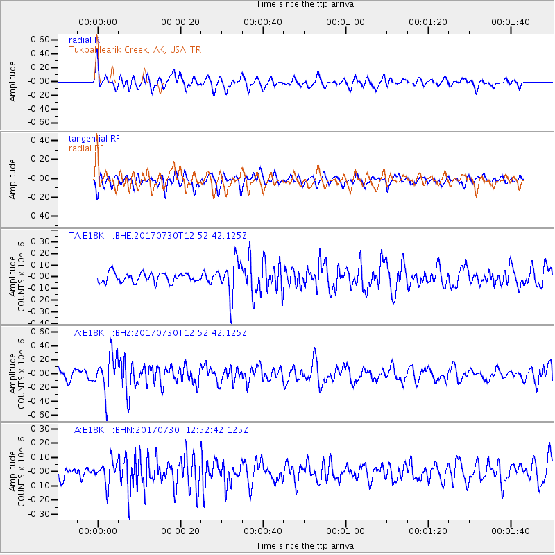
E18K Tukpahlearik Creek, AK, USA - Earthquake Result Viewer
*The percent match for this event was below the threshold and hence no stack was calculated.
| Earthquake location: |
Off East Coast Of Honshu, Japan |
| Earthquake latitude/longitude: |
36.3/143.7 |
| Earthquake time(UTC): |
2017/07/30 (211) 12:45:06 GMT |
| Earthquake Depth: |
17 km |
| Earthquake Magnitude: |
5.3 Mww |
| Earthquake Catalog/Contributor: |
NEIC PDE/us |
|
| Network: |
TA USArray Transportable Network (new EarthScope stations) |
| Station: |
E18K Tukpahlearik Creek, AK, USA |
| Lat/Lon: |
67.42 N/160.60 W |
| Elevation: |
297 m |
|
| Distance: |
44.0 deg |
| Az: |
27.34 deg |
| Baz: |
253.914 deg |
| Ray Param: |
$rayparam |
*The percent match for this event was below the threshold and hence was not used in the summary stack. |
|
| Radial Match: |
56.032436 % |
| Radial Bump: |
400 |
| Transverse Match: |
58.287678 % |
| Transverse Bump: |
400 |
| SOD ConfigId: |
13570011 |
| Insert Time: |
2019-04-28 12:15:52.260 +0000 |
| GWidth: |
2.5 |
| Max Bumps: |
400 |
| Tol: |
0.001 |
|
Signal To Noise
| Channel | StoN | STA | LTA |
| TA:E18K: :BHZ:20170730T12:52:42.125Z | 4.529713 | 2.8357195E-7 | 6.260262E-8 |
| TA:E18K: :BHN:20170730T12:52:42.125Z | 1.3299555 | 8.230136E-8 | 6.1882794E-8 |
| TA:E18K: :BHE:20170730T12:52:42.125Z | 3.945072 | 1.5623131E-7 | 3.9601638E-8 |
| Arrivals |
| Ps | |
| PpPs | |
| PsPs/PpSs | |


