You are here: Home > Network List > TA - USArray Transportable Network (new EarthScope stations) Stations List
> Station H28A Mission Ridge, SD, USA > Earthquake Result Viewer
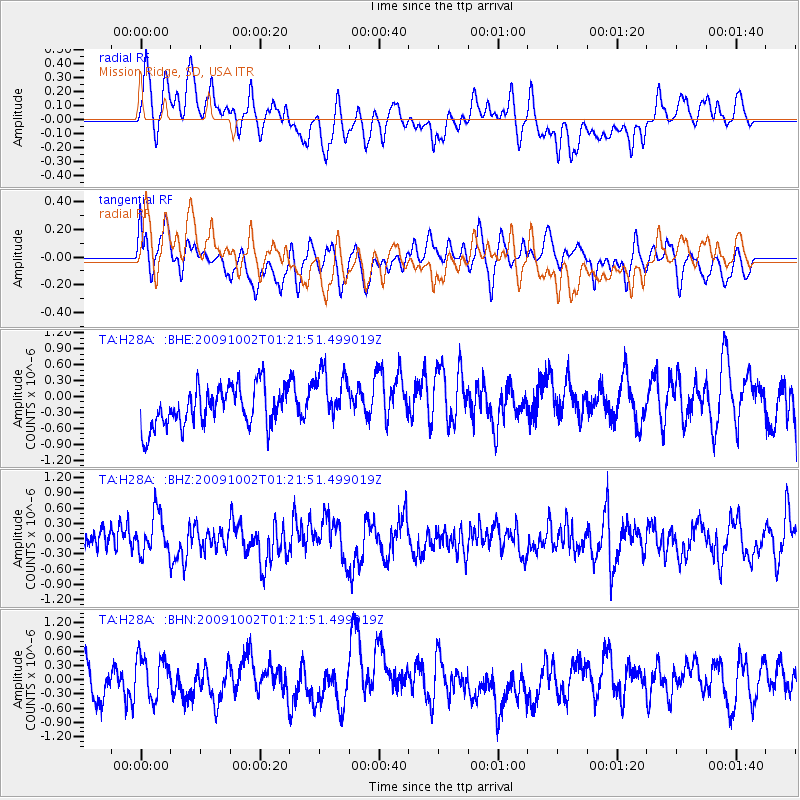
H28A Mission Ridge, SD, USA - Earthquake Result Viewer
*The percent match for this event was below the threshold and hence no stack was calculated.
| Earthquake location: |
Tonga Islands |
| Earthquake latitude/longitude: |
-16.2/-173.5 |
| Earthquake time(UTC): |
2009/10/02 (275) 01:09:26 GMT |
| Earthquake Depth: |
10 km |
| Earthquake Magnitude: |
5.5 MB |
| Earthquake Catalog/Contributor: |
WHDF/NEIC |
|
| Network: |
TA USArray Transportable Network (new EarthScope stations) |
| Station: |
H28A Mission Ridge, SD, USA |
| Lat/Lon: |
44.68 N/101.02 W |
| Elevation: |
642 m |
|
| Distance: |
89.3 deg |
| Az: |
42.866 deg |
| Baz: |
246.336 deg |
| Ray Param: |
$rayparam |
*The percent match for this event was below the threshold and hence was not used in the summary stack. |
|
| Radial Match: |
46.133 % |
| Radial Bump: |
400 |
| Transverse Match: |
47.264885 % |
| Transverse Bump: |
400 |
| SOD ConfigId: |
2622 |
| Insert Time: |
2010-03-06 02:26:00.486 +0000 |
| GWidth: |
2.5 |
| Max Bumps: |
400 |
| Tol: |
0.001 |
|
Signal To Noise
| Channel | StoN | STA | LTA |
| TA:H28A: :BHZ:20091002T01:21:51.499019Z | 1.2806405 | 4.1393224E-7 | 3.2322285E-7 |
| TA:H28A: :BHN:20091002T01:21:51.499019Z | 1.0678574 | 4.4976343E-7 | 4.2118305E-7 |
| TA:H28A: :BHE:20091002T01:21:51.499019Z | 1.3685882 | 5.043895E-7 | 3.685473E-7 |
| Arrivals |
| Ps | |
| PpPs | |
| PsPs/PpSs | |


