You are here: Home > Network List > TA - USArray Transportable Network (new EarthScope stations) Stations List
> Station I30M Mount Dempster, Yukon, CAN > Earthquake Result Viewer
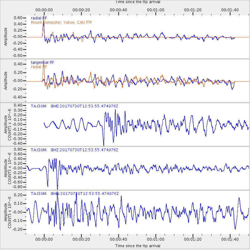
I30M Mount Dempster, Yukon, CAN - Earthquake Result Viewer
*The percent match for this event was below the threshold and hence no stack was calculated.
| Earthquake location: |
Off East Coast Of Honshu, Japan |
| Earthquake latitude/longitude: |
36.3/143.7 |
| Earthquake time(UTC): |
2017/07/30 (211) 12:45:06 GMT |
| Earthquake Depth: |
17 km |
| Earthquake Magnitude: |
5.3 Mww |
| Earthquake Catalog/Contributor: |
NEIC PDE/us |
|
| Network: |
TA USArray Transportable Network (new EarthScope stations) |
| Station: |
I30M Mount Dempster, Yukon, CAN |
| Lat/Lon: |
65.22 N/136.38 W |
| Elevation: |
1399 m |
|
| Distance: |
53.6 deg |
| Az: |
31.05 deg |
| Baz: |
278.588 deg |
| Ray Param: |
$rayparam |
*The percent match for this event was below the threshold and hence was not used in the summary stack. |
|
| Radial Match: |
71.64095 % |
| Radial Bump: |
400 |
| Transverse Match: |
61.831623 % |
| Transverse Bump: |
400 |
| SOD ConfigId: |
13570011 |
| Insert Time: |
2019-04-28 12:16:31.570 +0000 |
| GWidth: |
2.5 |
| Max Bumps: |
400 |
| Tol: |
0.001 |
|
Signal To Noise
| Channel | StoN | STA | LTA |
| TA:I30M: :BHZ:20170730T12:53:55.474976Z | 6.0695133 | 2.6895202E-7 | 4.4311957E-8 |
| TA:I30M: :BHN:20170730T12:53:55.474976Z | 1.0187627 | 5.539898E-8 | 5.4378688E-8 |
| TA:I30M: :BHE:20170730T12:53:55.474976Z | 2.455554 | 1.7453003E-7 | 7.1075625E-8 |
| Arrivals |
| Ps | |
| PpPs | |
| PsPs/PpSs | |


