You are here: Home > Network List > WY - Yellowstone Wyoming Seismic Network Stations List
> Station YHR Hawk's Rest, WY, USA > Earthquake Result Viewer
YHR Hawk's Rest, WY, USA - Earthquake Result Viewer
*The percent match for this event was below the threshold and hence no stack was calculated.
| Earthquake location: |
Hokkaido, Japan Region |
| Earthquake latitude/longitude: |
42.0/142.7 |
| Earthquake time(UTC): |
2016/01/14 (014) 03:25:34 GMT |
| Earthquake Depth: |
51 km |
| Earthquake Magnitude: |
6.7 MWP, 6.7 MI |
| Earthquake Catalog/Contributor: |
NEIC PDE/NEIC COMCAT |
|
| Network: |
WY Yellowstone Wyoming Seismic Network |
| Station: |
YHR Hawk's Rest, WY, USA |
| Lat/Lon: |
44.11 N/110.08 W |
| Elevation: |
2976 m |
|
| Distance: |
72.4 deg |
| Az: |
46.231 deg |
| Baz: |
311.605 deg |
| Ray Param: |
$rayparam |
*The percent match for this event was below the threshold and hence was not used in the summary stack. |
|
| Radial Match: |
82.810524 % |
| Radial Bump: |
400 |
| Transverse Match: |
78.26629 % |
| Transverse Bump: |
400 |
| SOD ConfigId: |
1399611 |
| Insert Time: |
2016-01-28 04:41:49.582 +0000 |
| GWidth: |
2.5 |
| Max Bumps: |
400 |
| Tol: |
0.001 |
|
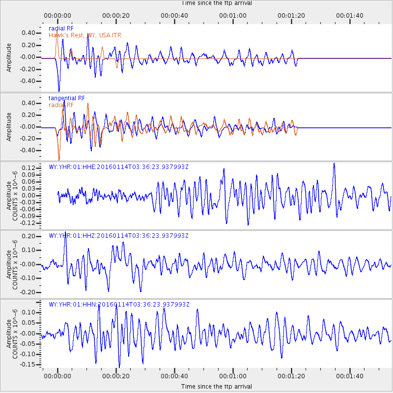
Signal To Noise
| Channel | StoN | STA | LTA |
| WY:YHR:01:HHZ:20160114T03:36:23.937993Z | 6.169957 | 8.30531E-8 | 1.34608875E-8 |
| WY:YHR:01:HHN:20160114T03:36:23.937993Z | 3.5277417 | 3.8107792E-8 | 1.080232E-8 |
| WY:YHR:01:HHE:20160114T03:36:23.937993Z | 1.8638242 | 2.9791423E-8 | 1.598403E-8 |
| Arrivals |
| Ps | |
| PpPs | |
| PsPs/PpSs | |


