You are here: Home > Network List > TA - USArray Transportable Network (new EarthScope stations) Stations List
> Station I26A New Underwood, SD, USA > Earthquake Result Viewer
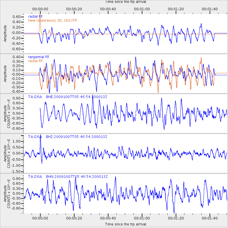
I26A New Underwood, SD, USA - Earthquake Result Viewer
*The percent match for this event was below the threshold and hence no stack was calculated.
| Earthquake location: |
Rat Islands, Aleutian Islands |
| Earthquake latitude/longitude: |
52.2/178.1 |
| Earthquake time(UTC): |
2009/10/07 (280) 05:38:37 GMT |
| Earthquake Depth: |
138 km |
| Earthquake Magnitude: |
5.6 MB, 5.6 MW, 5.6 MW |
| Earthquake Catalog/Contributor: |
WHDF/NEIC |
|
| Network: |
TA USArray Transportable Network (new EarthScope stations) |
| Station: |
I26A New Underwood, SD, USA |
| Lat/Lon: |
44.03 N/102.86 W |
| Elevation: |
971 m |
|
| Distance: |
51.0 deg |
| Az: |
65.742 deg |
| Baz: |
308.858 deg |
| Ray Param: |
$rayparam |
*The percent match for this event was below the threshold and hence was not used in the summary stack. |
|
| Radial Match: |
55.059116 % |
| Radial Bump: |
400 |
| Transverse Match: |
53.89718 % |
| Transverse Bump: |
374 |
| SOD ConfigId: |
2622 |
| Insert Time: |
2010-03-06 02:27:07.044 +0000 |
| GWidth: |
2.5 |
| Max Bumps: |
400 |
| Tol: |
0.001 |
|
Signal To Noise
| Channel | StoN | STA | LTA |
| TA:I26A: :BHZ:20091007T05:46:54.200013Z | 3.3883803 | 4.777223E-7 | 1.4098839E-7 |
| TA:I26A: :BHN:20091007T05:46:54.200013Z | 0.9816165 | 3.2422633E-7 | 3.3029838E-7 |
| TA:I26A: :BHE:20091007T05:46:54.200013Z | 1.529127 | 5.049097E-7 | 3.3019472E-7 |
| Arrivals |
| Ps | |
| PpPs | |
| PsPs/PpSs | |


