You are here: Home > Network List > TA - USArray Transportable Network (new EarthScope stations) Stations List
> Station G23K Bananza Creek, AK, USA > Earthquake Result Viewer
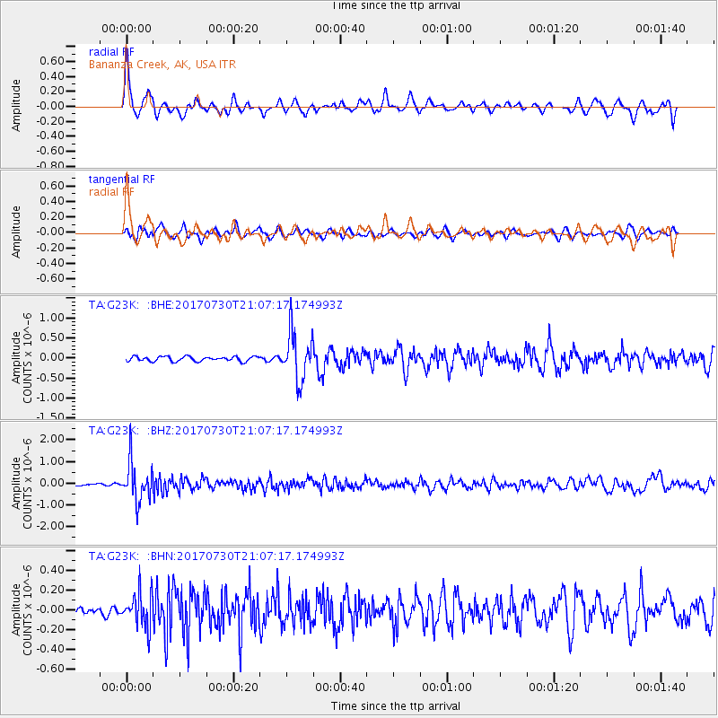
G23K Bananza Creek, AK, USA - Earthquake Result Viewer
*The percent match for this event was below the threshold and hence no stack was calculated.
| Earthquake location: |
Kuril Islands |
| Earthquake latitude/longitude: |
46.2/151.0 |
| Earthquake time(UTC): |
2017/07/30 (211) 21:00:49 GMT |
| Earthquake Depth: |
87 km |
| Earthquake Magnitude: |
5.7 mb |
| Earthquake Catalog/Contributor: |
NEIC PDE/us |
|
| Network: |
TA USArray Transportable Network (new EarthScope stations) |
| Station: |
G23K Bananza Creek, AK, USA |
| Lat/Lon: |
66.71 N/150.02 W |
| Elevation: |
746 m |
|
| Distance: |
36.6 deg |
| Az: |
34.832 deg |
| Baz: |
265.98 deg |
| Ray Param: |
$rayparam |
*The percent match for this event was below the threshold and hence was not used in the summary stack. |
|
| Radial Match: |
76.370804 % |
| Radial Bump: |
400 |
| Transverse Match: |
74.38026 % |
| Transverse Bump: |
400 |
| SOD ConfigId: |
13570011 |
| Insert Time: |
2019-04-28 12:29:11.793 +0000 |
| GWidth: |
2.5 |
| Max Bumps: |
400 |
| Tol: |
0.001 |
|
Signal To Noise
| Channel | StoN | STA | LTA |
| TA:G23K: :BHZ:20170730T21:07:17.174993Z | 13.042914 | 9.066283E-7 | 6.9511174E-8 |
| TA:G23K: :BHN:20170730T21:07:17.174993Z | 4.69027 | 1.7474098E-7 | 3.725606E-8 |
| TA:G23K: :BHE:20170730T21:07:17.174993Z | 10.292586 | 6.0299845E-7 | 5.858571E-8 |
| Arrivals |
| Ps | |
| PpPs | |
| PsPs/PpSs | |


