You are here: Home > Network List > US - United States National Seismic Network Stations List
> Station MSO Missoula, Montana, USA > Earthquake Result Viewer
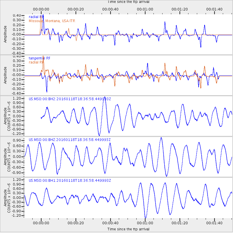
MSO Missoula, Montana, USA - Earthquake Result Viewer
*The percent match for this event was below the threshold and hence no stack was calculated.
| Earthquake location: |
South Of Fiji Islands |
| Earthquake latitude/longitude: |
-21.5/176.2 |
| Earthquake time(UTC): |
2016/01/18 (018) 18:24:17 GMT |
| Earthquake Depth: |
4.7 km |
| Earthquake Magnitude: |
5.8 MWW, 5.8 MWB, 5.9 MWC |
| Earthquake Catalog/Contributor: |
NEIC PDE/NEIC COMCAT |
|
| Network: |
US United States National Seismic Network |
| Station: |
MSO Missoula, Montana, USA |
| Lat/Lon: |
46.83 N/113.94 W |
| Elevation: |
1264 m |
|
| Distance: |
92.5 deg |
| Az: |
40.194 deg |
| Baz: |
241.113 deg |
| Ray Param: |
$rayparam |
*The percent match for this event was below the threshold and hence was not used in the summary stack. |
|
| Radial Match: |
58.254223 % |
| Radial Bump: |
400 |
| Transverse Match: |
40.55233 % |
| Transverse Bump: |
369 |
| SOD ConfigId: |
1399611 |
| Insert Time: |
2016-02-01 18:48:36.375 +0000 |
| GWidth: |
2.5 |
| Max Bumps: |
400 |
| Tol: |
0.001 |
|
Signal To Noise
| Channel | StoN | STA | LTA |
| US:MSO:00:BHZ:20160118T18:36:58.449993Z | 1.2403352 | 5.053973E-7 | 4.074683E-7 |
| US:MSO:00:BH1:20160118T18:36:58.449993Z | 1.9155365 | 4.2763492E-7 | 2.2324551E-7 |
| US:MSO:00:BH2:20160118T18:36:58.449993Z | 2.4216828 | 7.444181E-7 | 3.0739702E-7 |
| Arrivals |
| Ps | |
| PpPs | |
| PsPs/PpSs | |


