You are here: Home > Network List > TA - USArray Transportable Network (new EarthScope stations) Stations List
> Station L20K Farewell, AK, USA > Earthquake Result Viewer
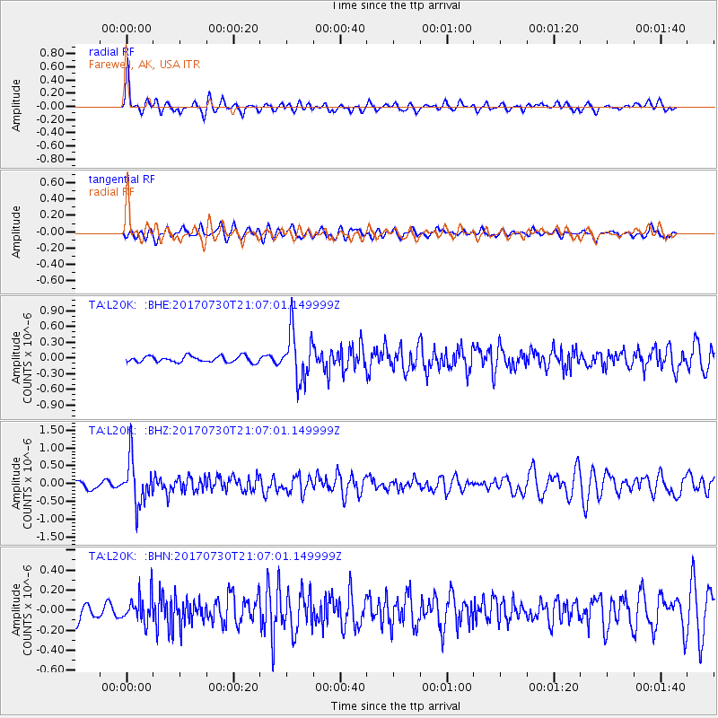
L20K Farewell, AK, USA - Earthquake Result Viewer
*The percent match for this event was below the threshold and hence no stack was calculated.
| Earthquake location: |
Kuril Islands |
| Earthquake latitude/longitude: |
46.2/151.0 |
| Earthquake time(UTC): |
2017/07/30 (211) 21:00:49 GMT |
| Earthquake Depth: |
87 km |
| Earthquake Magnitude: |
5.7 mb |
| Earthquake Catalog/Contributor: |
NEIC PDE/us |
|
| Network: |
TA USArray Transportable Network (new EarthScope stations) |
| Station: |
L20K Farewell, AK, USA |
| Lat/Lon: |
62.48 N/153.88 W |
| Elevation: |
673 m |
|
| Distance: |
34.8 deg |
| Az: |
41.961 deg |
| Baz: |
268.291 deg |
| Ray Param: |
$rayparam |
*The percent match for this event was below the threshold and hence was not used in the summary stack. |
|
| Radial Match: |
77.97201 % |
| Radial Bump: |
354 |
| Transverse Match: |
59.060764 % |
| Transverse Bump: |
400 |
| SOD ConfigId: |
13570011 |
| Insert Time: |
2019-04-28 12:29:52.057 +0000 |
| GWidth: |
2.5 |
| Max Bumps: |
400 |
| Tol: |
0.001 |
|
Signal To Noise
| Channel | StoN | STA | LTA |
| TA:L20K: :BHZ:20170730T21:07:01.149999Z | 6.272983 | 6.351127E-7 | 1.01245725E-7 |
| TA:L20K: :BHN:20170730T21:07:01.149999Z | 1.7808663 | 1.3592448E-7 | 7.632492E-8 |
| TA:L20K: :BHE:20170730T21:07:01.149999Z | 8.059407 | 4.7135973E-7 | 5.8485654E-8 |
| Arrivals |
| Ps | |
| PpPs | |
| PsPs/PpSs | |


