You are here: Home > Network List > TA - USArray Transportable Network (new EarthScope stations) Stations List
> Station MDND Maddock, ND, USA > Earthquake Result Viewer
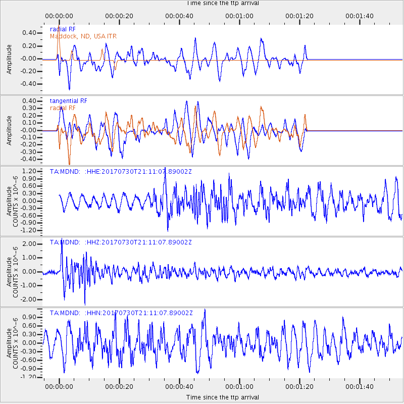
MDND Maddock, ND, USA - Earthquake Result Viewer
*The percent match for this event was below the threshold and hence no stack was calculated.
| Earthquake location: |
Kuril Islands |
| Earthquake latitude/longitude: |
46.2/151.0 |
| Earthquake time(UTC): |
2017/07/30 (211) 21:00:49 GMT |
| Earthquake Depth: |
87 km |
| Earthquake Magnitude: |
5.7 mb |
| Earthquake Catalog/Contributor: |
NEIC PDE/us |
|
| Network: |
TA USArray Transportable Network (new EarthScope stations) |
| Station: |
MDND Maddock, ND, USA |
| Lat/Lon: |
47.85 N/99.60 W |
| Elevation: |
479 m |
|
| Distance: |
67.9 deg |
| Az: |
43.275 deg |
| Baz: |
315.031 deg |
| Ray Param: |
$rayparam |
*The percent match for this event was below the threshold and hence was not used in the summary stack. |
|
| Radial Match: |
45.845818 % |
| Radial Bump: |
400 |
| Transverse Match: |
44.38305 % |
| Transverse Bump: |
314 |
| SOD ConfigId: |
13570011 |
| Insert Time: |
2019-04-28 12:30:07.643 +0000 |
| GWidth: |
2.5 |
| Max Bumps: |
400 |
| Tol: |
0.001 |
|
Signal To Noise
| Channel | StoN | STA | LTA |
| TA:MDND: :HHZ:20170730T21:11:07.89002Z | 7.6614456 | 9.1009605E-7 | 1.1878907E-7 |
| TA:MDND: :HHN:20170730T21:11:07.89002Z | 1.8260913 | 5.320347E-7 | 2.9135165E-7 |
| TA:MDND: :HHE:20170730T21:11:07.89002Z | 1.4554982 | 3.13569E-7 | 2.1543757E-7 |
| Arrivals |
| Ps | |
| PpPs | |
| PsPs/PpSs | |


