You are here: Home > Network List > UW - Pacific Northwest Regional Seismic Network Stations List
> Station UMAT Pilot Rock, OR, USA > Earthquake Result Viewer
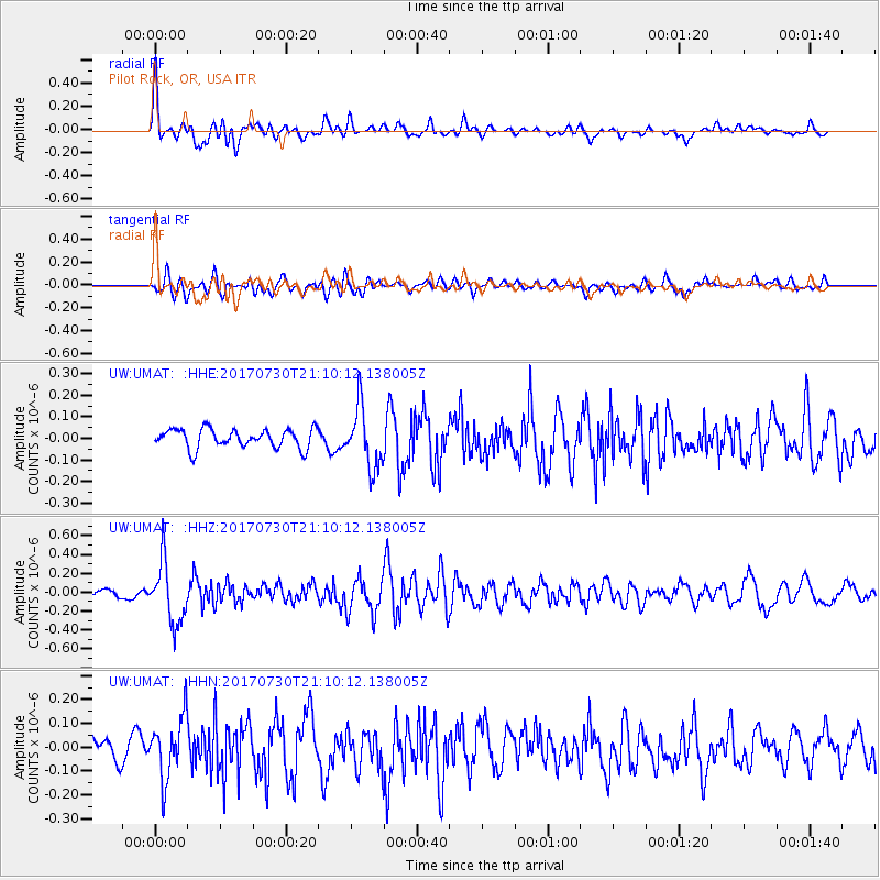
UMAT Pilot Rock, OR, USA - Earthquake Result Viewer
*The percent match for this event was below the threshold and hence no stack was calculated.
| Earthquake location: |
Kuril Islands |
| Earthquake latitude/longitude: |
46.2/151.0 |
| Earthquake time(UTC): |
2017/07/30 (211) 21:00:49 GMT |
| Earthquake Depth: |
87 km |
| Earthquake Magnitude: |
5.7 mb |
| Earthquake Catalog/Contributor: |
NEIC PDE/us |
|
| Network: |
UW Pacific Northwest Regional Seismic Network |
| Station: |
UMAT Pilot Rock, OR, USA |
| Lat/Lon: |
45.29 N/118.96 W |
| Elevation: |
1318 m |
|
| Distance: |
59.4 deg |
| Az: |
55.088 deg |
| Baz: |
306.223 deg |
| Ray Param: |
$rayparam |
*The percent match for this event was below the threshold and hence was not used in the summary stack. |
|
| Radial Match: |
76.69055 % |
| Radial Bump: |
400 |
| Transverse Match: |
67.07587 % |
| Transverse Bump: |
400 |
| SOD ConfigId: |
13570011 |
| Insert Time: |
2019-04-28 12:31:52.091 +0000 |
| GWidth: |
2.5 |
| Max Bumps: |
400 |
| Tol: |
0.001 |
|
Signal To Noise
| Channel | StoN | STA | LTA |
| UW:UMAT: :HHZ:20170730T21:10:12.138005Z | 5.7484226 | 3.231512E-7 | 5.621563E-8 |
| UW:UMAT: :HHN:20170730T21:10:12.138005Z | 2.5934348 | 1.2838635E-7 | 4.950436E-8 |
| UW:UMAT: :HHE:20170730T21:10:12.138005Z | 3.1703763 | 1.395966E-7 | 4.4031555E-8 |
| Arrivals |
| Ps | |
| PpPs | |
| PsPs/PpSs | |


